Saving Chunks of SSURGO Data in SoilWeb for Google Earth
Jun 29, 2011 metroadmin SoilWeb is an interactive, multifaceted interface to USDA-NCSS soil survey information. Our SoilWeb application for Google Earth streams soil map units and point data as you navigate across the lower '48 states. Currently, our system imposes a 30,000 ac. limit (defined by the Google Earth viewport) for streaming detailed soil survey (SSURGO) map unit boundaries. This limit, combined with a 2 second delay before streaming is initiated, helps to reduce CPU load on our server. When viewing landscapes from directly overhead the 30,000 ac. limit is usually sufficient for most soils investigations. However, tilting the camera for oblique views of the landscape (an excellent way of visualizing soil-landscape relationships) causes the viewport to encompass much larger areas, usually exceeding SoilWeb's limit for detailed linework. The solution to this problem is summarized below, and can also be used to save "chunks" of detailed soil survey information for later use or offline browsing.

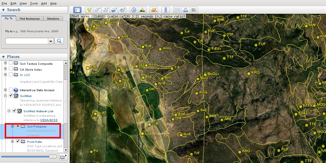
Fig 1: right-click on the layer highlighted above and choose "copy"
Step 1: Zoom to a region of interest, just below the 30,000 ac. limit, and pause for 2 seconds while our server processes your query. You can use the small status bar in the upper-left corner of the viewport to determine the current area, survey areas, and time required for processing. Once the linework has been displayed, right-click on the "Soil Polygons" sub-folder of the SoilWeb entry within the list of layers (Fig 1), and choose "copy". This will create a temporary snippet of KML that describes all map unit line work, labels, and associated links visible within the current viewport and place it on your clipboard. You can inspect this KML snippet by pasting it into a text editor.

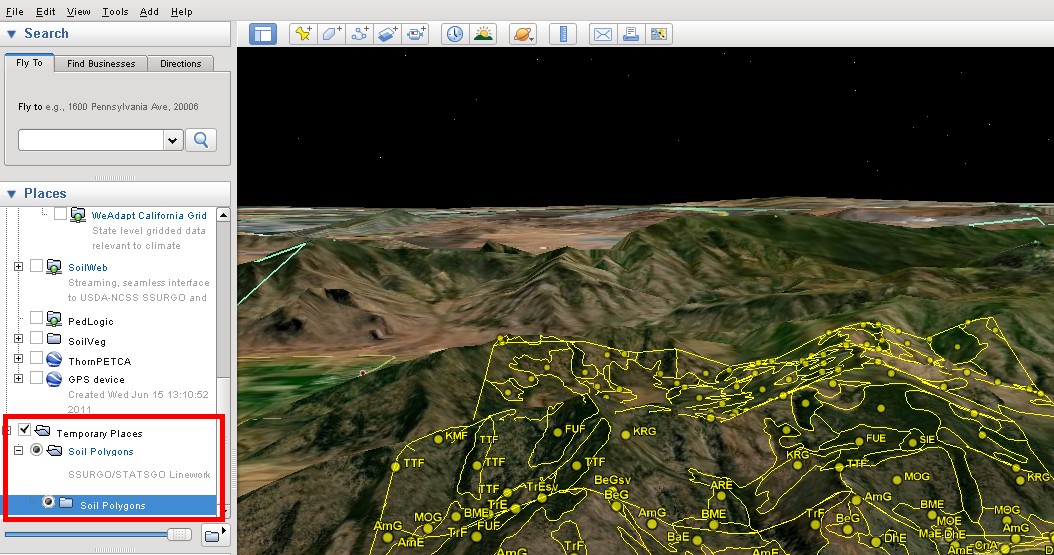
Fig 2: right-click on the "Temporary Places" folder and choose "paste"
Step 2: Next, right-click on the "Temporary Places" folder within the list of layers (Fig 2), and choose "paste". This will create a new KML folder within your Temporary Places. You can make this KML snippet permanent by right-clicking on your new snippet and choosing "save place as", or by dragging your snippet into the "My Places" folder above. Finally, disable the SoilWeb network link and adjust the camera position for optimal viewing of your new KML snippet.
Links:
Planned Improvements in SoilWeb
SoilWeb: An Online Soil Survey Browser
Soil Properties Visualized on a 1km Grid

