Soil Series Query for SoilWeb
Sep 16, 2011 metroadminA map depicting the spatial distribution of a given soil series can be very useful when working on a new soil survey, updating an old one, or searching for specific soil characteristics. We have recently added a soil series query facility to SoilWeb, where results are returned in the form of a KML file. Two modes are currently supported:
- map unit based querying- only map units named for the given soil series are returned
- component based querying- map units containing components named for the given series are returned
For example, if someone was interested in the spatial distribution of the Amador soil series, they could use the Series Extent Mapping tool to get a quick description of which survey areas contain (and how many corresponding acres of) this series. For an even more detailed description of where the Amador series is mapped, one could use our new soil series query like this:
http://casoilresource.lawr.ucdavis.edu/soil_web/reflector_api/soils.php?what=soil_series_extent&q_string=amador
This is a preliminary version, and a subsequent post will contain links to a Google Earth file that can be used to simplify the query process. In most cases queries take about 1-5 seconds, which is quite fast considering: 1) either 730k component names or 275k map unit names are searched, 2) 35 million map unit polygons are filtered for the series in question, and, 3) bounding boxes for matching polygons are merged together-- all on-the-fly. Full text searches for map unit/component names are very fast thanks to advanced text indexing and searching algorithms implemented in PostgreSQL and spatial processing functions implemented in PostGIS. In the final version, the location of the official series description (OSD) will be included in query results.
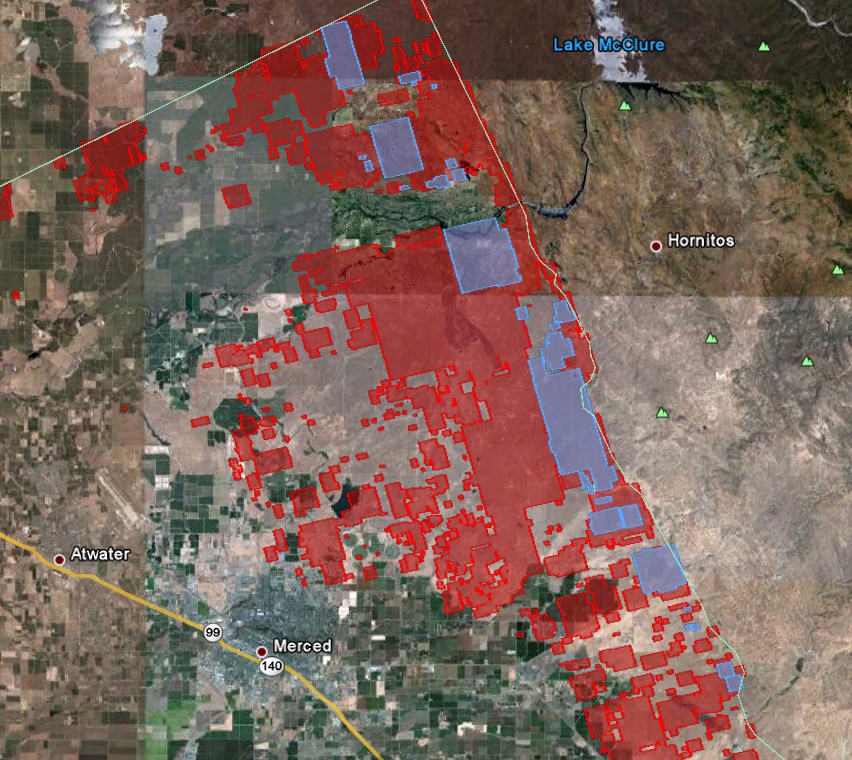
Attached at the bottom of the page is a KMZ demo showing sample output from the two query modes. Screen shots from the demo are posted below.

Image: Soil Series Query Results: Amador Series: blue regions: map units dominated by the Amador series; red regions: map units that contain at least one component of the Amador series.

