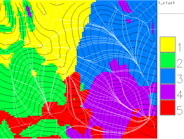
Regions of like SD(elevation)
Compute SD of elevation on 50x50 meter grid
Cluster on (standardized) coordinates and SD of elevation
Finish up in GRASS
Regions of like SD(elevation)
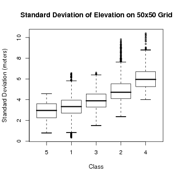
Elevation standard deviation classes

Compute SD of elevation on 50x50 meter grid
Cluster on (standardized) coordinates and SD of elevation
Finish up in GRASS
Regions of like SD(elevation)
Elevation standard deviation classes
