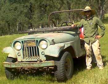
Dylan E. Beaudette

Dylan Beaudette is currently a soil scientist working for the NRCS on soil survey in the Sierra Foothill Region of California. He was formerly a graduate student in the Soils and Biogeochemistry group at UC Davis. He is interested in applying numerical methods to soil survey, soil classification, and towards a more complete understanding of soil genesis. Dylan is currently working on several studies related to scaling soil survey information down to the landscape-scale, and up to the regional scale. These experiments involve (sensor-calibrated) quantification of soil climate, modeling of geomorphic surfaces, and estimation of within map unit variability. Dylan is also interested in the potential Soil Survey has to become a valuable educational tool. Open source software is used in all of his research, data management, analysis, and presentation tasks. Occasionally he posts snippets from his research here.
Contact Information
debeaudette at ucdavis dot edu
209.532.3671 x374
USDA-NRCS Soil Survey Office
19777 Greenley Road
Sonora, CA 95370
Education (Curriculum Vitae)
- Ph.D. Soils and Biogeochemistry
June 2007 - May 2011 [U.C. Davis]- An iPhone application for on demand access to digital soil survey information. (doi: 10.2136/sssaj2010.0144N)
- Algorithms for Quantitative Pedology: A Toolkit for Soil Scientists [CRAN] [R-Forge]
- Terrain-Shape Indices for Modeling Soil Moisture Dynamics. (doi:10.2136/sssaj2013.02.0048)
- A Quantitative Study on Soil-Landscape Relationships of the Sierra Foothill Region of California
- Modeling Soil Property Depth Functions with Restricted Cubic Splines
- M.S. Soils and Biogeochemistry
September 2004 - March 2008 [U.C. Davis] - B.S. Environmental Resource Science
Minor in Japanese
June 2004 [U.C. Davis]
- AQP: A New Framework for Quantitative Analysis of Pedon Data [Western Regional Cooperative Soil Survey 2012 - Davis, NE]
- A generalized algorithm for determining pair-wise dissimilarity between soil pro files [Universal Soil Classification 2012 - Lincoln, NE]
- GEOSTAT 2011 - Landau, DE (Guest Instructor)
- GEOSTAT 2011 - Canberra, AU (Guest Instructor)
- Modeling the Landscape: Investigating soil genesis and geography with R [Bay Area UserR Group - Feb. 2011]
- A Evaluation of Soil-Landscape Relationships in the Sierra Foothill Region of California [Soil Science Society of America - 2010]
- An iPhone Application for on Demand Access to Digital Soil Survey Information [Western Regional Cooperative Soil Survey - 2010]
- Down-Scaling Soil Survey Data in the Sierra Foothills [Soil Science Society of America - 2009]
- Predicting the Occurrence of Upland Mollisols with Solar Radiation Modeling [Soil Science Society of America - 2007]
- Wilderness Navigational Planning with GRASS GIS and Public Data [Where 2.0 - 2006]
Affiliations

