
GIS and Digital Soil Survey Projects
My lab produces a variety of interpretive maps that have been repackaged from Digital Soil Survey and other geographic datasets.
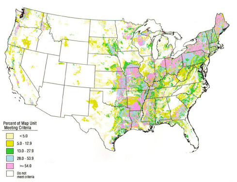
Soils with perched water tables repackaged from USDA-NRCS STATSGO database.
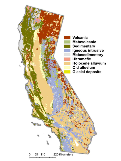
General map of the lithology of soil parent materials in the California.
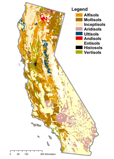
General map of soil orders in California, repackaged from USDA-NRCS STATSGO database.
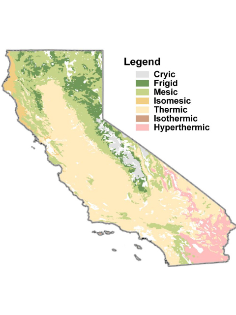
General map of soil temperature regimes in California, repackaged from USDA-NRCS STATSGO database.
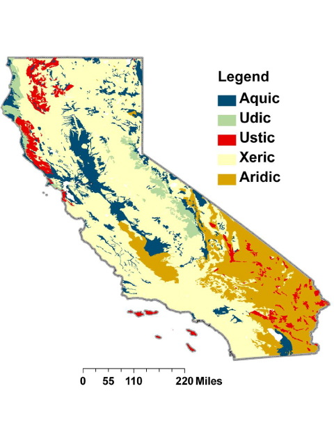
General map of soil moisture regimes in California, repackaged from USDA-NRCS STATSGO database.
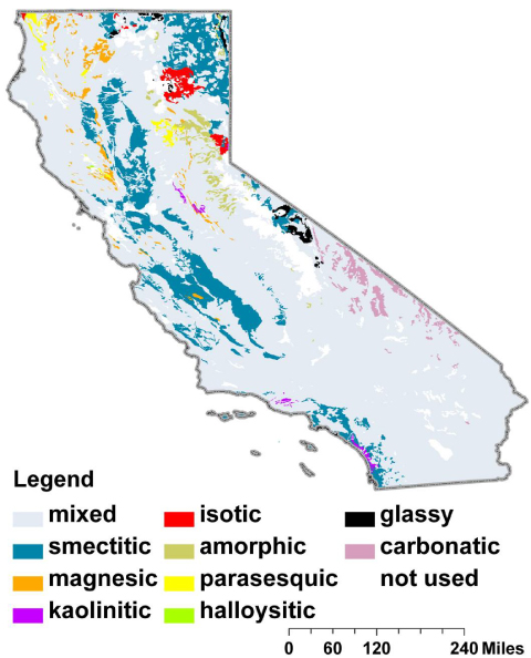
General map of soil mineralogy class in California, repackaged from USDA-NRCS STATSGO database.
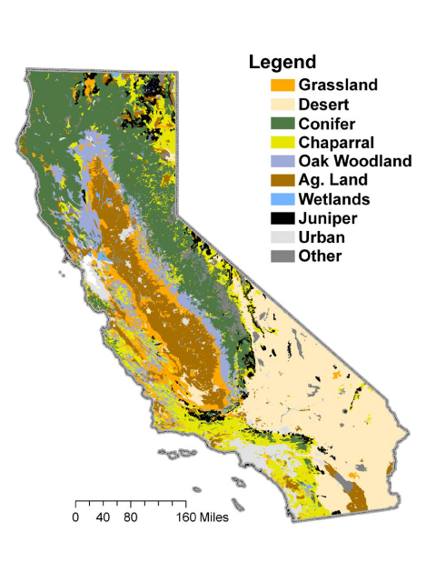
General map of vegetation in California, data source: GAP Analysis Program.
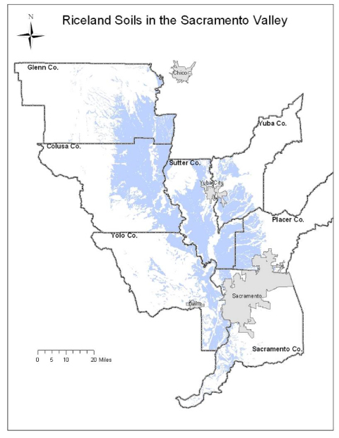
GIS model of soil that could support rice in the Sacramento Valley, repackaged from USDA-NRCS SSURGO database.
