
Characterization of Terrain Shape, Microclimate, and Canopy Cover
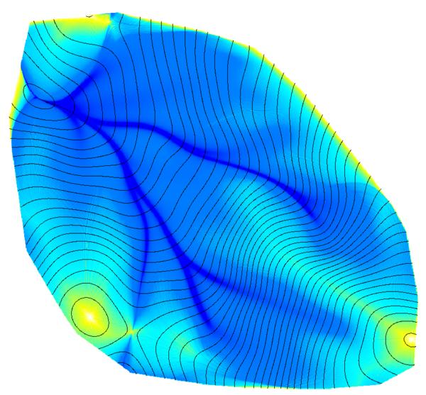
Flowline Density: D-inf. flow routing algorithm
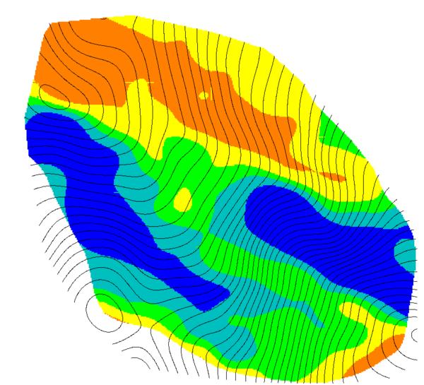
Estimated Ann. Beam Radiance: Quantiles: blue < light blue < green < yellow < orange
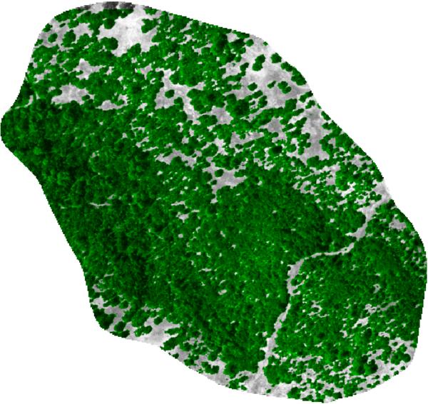
Estimated Canopy Cover: estimated from NAIP imagery, by SMAP supervised classification.
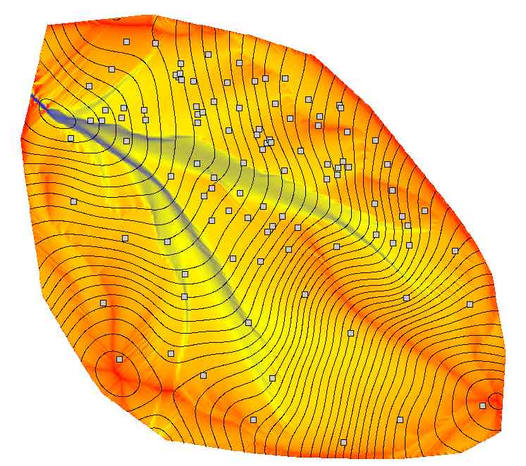
MFD Accumulation Map-1: Updated flow accumulation from r.watershed using MFD, convergence=1.
