
SoilWeb Apps
SoilWeb products can be used to access USDA-NCSS detailed soil survey data (SSURGO) for most of the United States. Please choose an interface to SoilWeb:
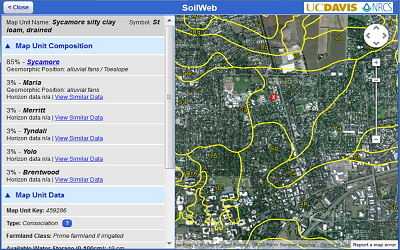
SoilWebExplore soil survey areas using an interactive Google map. View detailed information about map units and their components. This app runs in your web browser and is compatible with desktop computers, tablets, and smartphones.
|
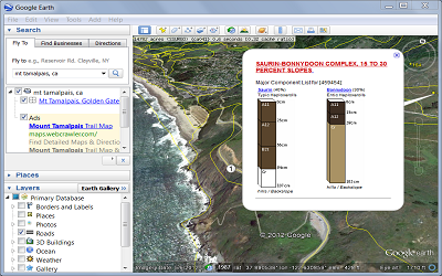
SoilWeb EarthSoil survey data are delivered dynamically in a KML file, allowing you to view mapped areas in a 3-D display. You must have Google Earth or some other means of viewing KML files installed on your desktop computer, tablet, or smartphone.
|
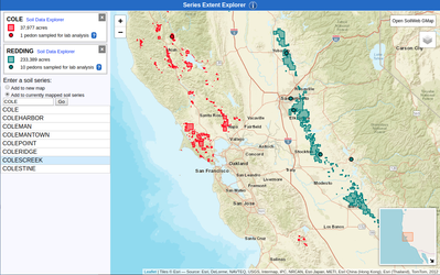
SEE: Soil Series Extent ExplorerExplore the spatial extent of soil types nationwide.
|
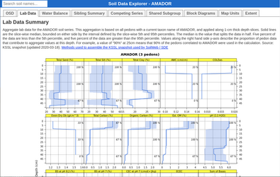
SDE: Soil Series Data ExplorerView detailed information about a given soil series.
|
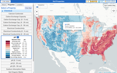
Soil PropertiesView regional trends for a variety of soil properties.
|
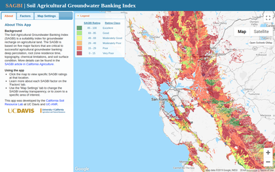
Soil Agricultural Groundwater Banking Index (SAGBI)Identify the suitability of soils for on-farm groundwater recharge in California.
|
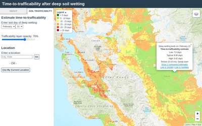
Soil Time-To-TrafficabilityIdentify the time-to-trafficability of fields after deep wetting.
|
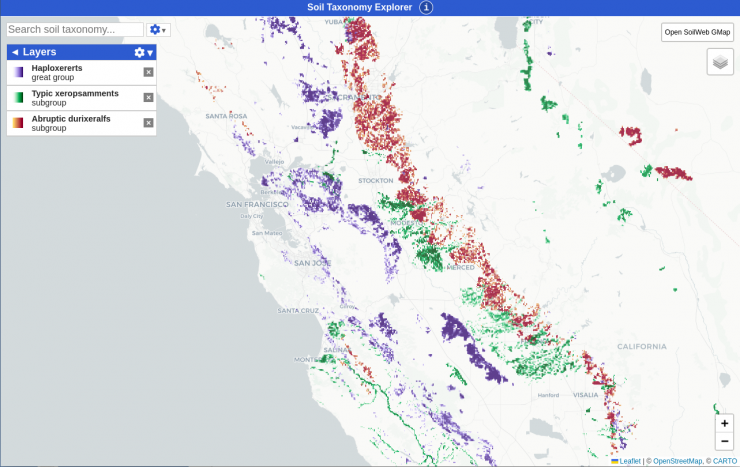
STE: Soil Taxonomy ExplorerExplore the spatial extent of soil taxonomic groups nationwide.
|
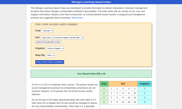
Nitrogen Leaching Hazard IndexIdentify the risk of nitrate leaching for soils and cropping systems in California.
|
|
iOS and Android appsThese are native smartphone apps that use your device's GPS to give soil information for your current location. |
Text InterfaceChoose from a list of available survey areas and map units to view the soil information of interest to you. |
Through our collaboration with the Center for Ecosystem Climate Solutions (CECS), we have developed these decision support tools:
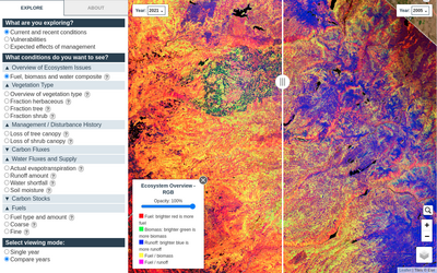
CECS Data AtlasThis app showcases unique datasets created by CECS, providing an overview of current and historical ecosystem conditions throughout California, as well as predictions for outcomes of potential management.
|
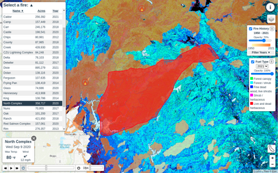
CECS Fire Progression AppThis app highlights several large-scale California wildfires since 2012, showing their daily rate of spread. Historical fire perimeters and fuel type layers can also be viewed for greater context.
|
For comments or questions about SoilWeb, please contact:
Toby O'Geen, Ph.D.
Dept. of Land, Air and Water Resources
University of California, Davis
atogeen@ucdavis.edu | 530-752-2155
