Visualizing Terrain Surface Indicies with Scaled Arrows
Apr 30, 2011 metroadminHamish Bowman recently posted a new GRASS module (d.barb) that can be used to depict the direction and magnitude components of some vector (e.g. wind) field along a raster surface or at points in space. An example (c/o Hamish):
The example above reminded me of an idea I once had, related to the depiction of potential
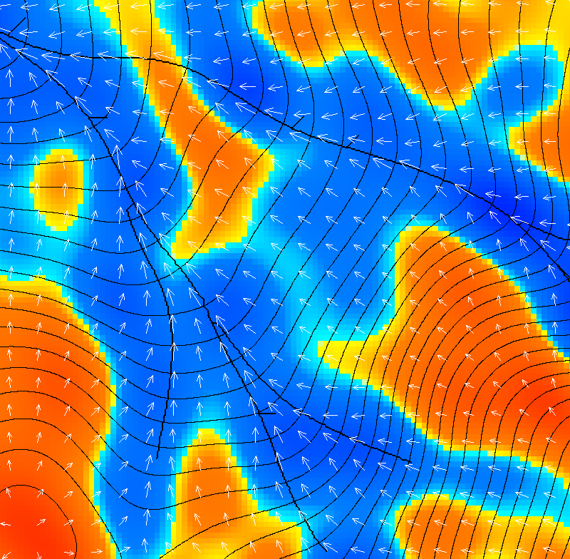
water/sediment fluxes along landscape gradients. In this case, the direction of the arrows would be determined by the dominant down-slope direction (aspect angle), and the magnitude of the arrows would be determined by some estimate of down-slope accumulation (CTI). It might look something like this:

Figure: Terrain shape indices depicted by scaled arrows: color describes mean curvature (red = convex, blue = concave), contours describe elevation surface, arrow direction is aspect angle, arrow magnitude is the comound topograpic index (CTI)

