
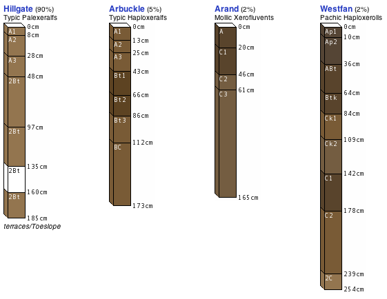
Figure: Soil Profiles in Color
Added color support to the mini-profiles used in graphical map unit summaries, the Google Earth interface, and iPhone application. SSURGO doesn't contain soil color data, so colors (in Munsell notation) were extracted from the OSD database, and converted into RGB triplets. Using horizon information from the OSD database also results in much more realistic horizonation, as compared to what is stored in older SSURGO databases. Example of the Yolo series soil, from the Yolo County (1972) soil survey:
