
I have posted a couple examples in the past on the topic of high quality map production from GRASS GIS-- usually via the Generic Mapping Tools. I am not sure why, but I have previously avoided using the traditional cartographic output module that is bundled with GRASS (ps.map). This is despite the fact that there is now an excellent collection of examples and a very detailed manual page... I now realize that I have been missing out.
I needed a map with several "zoomed" insets, on rather short notice, with all of the data derived from work that had previously done in GRASS. Not looking forward to exporting all of the data into a GMT-compatible format, I gave ps.map a try. The following image is a JPG (i.e. degraded) version of the Postscript file generated by ps.map, with no manual intervention (other than page layout). Obviously the labels aren't readable, but that can be fixed within a drawing program like Inkscape. Overall, the results were much better than I was expecting. I'll post some notes and the script used to generate the map next time.
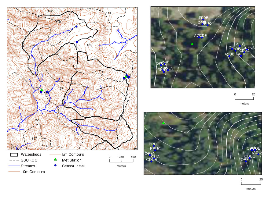
Figure: Example map produced with ps.map
