Lester-Estherville complex, 12 to 18 percent slopes, eroded
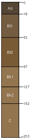
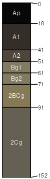
Lester
(65%)
Loamy Upland Savannas
Mollic Hapludalfs
Well drained
Hydric: No
PAWS: 26 cm
hills
moraines
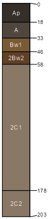
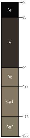
Estherville
(25%)
Sandy Upland Prairies
Typic Hapludolls
Somewhat excessively drained
Hydric: No
PAWS: 11 cm
knolls
moraines
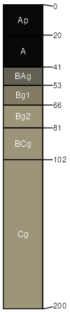
Webster
(2%)
Loamy Wet Prairies
Typic Endoaquolls
Poorly drained
Hydric: Yes
PAWS: 27 cm
drainageways
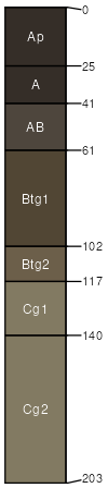
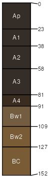
Hamel
(2%)
Footslope/Drainageway Forests
Typic Argiaquolls
Poorly drained
Hydric: Yes
PAWS: 29 cm
drainageways
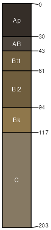
Biscay
(2%)
Sandy Wet Prairies
Typic Endoaquolls
Poorly drained
Hydric: Yes
PAWS: 21 cm
drainageways
Glencoe
(2%)
Depressional Marsh
Cumulic Endoaquolls
Very poorly drained
Hydric: Yes
PAWS: 29 cm
depressions
Terril
(1%)
Footslope/Drainageway Forests
Cumulic Hapludolls
Moderately well drained
Hydric: No
PAWS: 30 cm
moraines
Le Sueur
(1%)
Loamy Upland Forests
Aquic Argiudolls
Somewhat poorly drained
Hydric: No
PAWS: 27 cm
flats
SSA
Scale
Published
Export
mn047
1:16,000
1977
2025-09-10