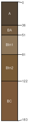
Chickasha (35%)
Loamy Upland
Udic Argiustolls
Well drained
Hydric: No
PAWS: 25 cm |
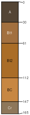
hillslopes / Summit hillslopes / Shoulder hillslopes / Backslope
|
|
Zaneis (30%)
Loamy Upland
Udic Argiustolls
Well drained
Hydric: No
PAWS: 25 cm |
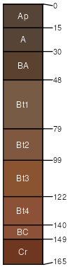
hillslopes / Summit hillslopes / Shoulder hillslopes / Backslope
|
|
Gullied land (15%)
Well drained
Hydric: No
PAWS: NA |

|
|
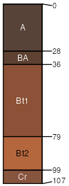
Coyle (10%)
Loamy Upland
Udic Argiustolls
Well drained
Hydric: No
PAWS: NA |
|
|
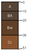
Lucien (5%)
Shallow Upland
Udic Haplustolls
Well drained
Hydric: No
PAWS: NA |
|
|
Seminole (5%)
Claypan Upland (North)
Typic Natrustolls
Moderately well drained
Hydric: No
PAWS: NA |
hillslopes / Summit hillslopes / Shoulder hillslopes / Backslope
|
|