Satanta-Sampson, loams, 0 to 3 percent slopes, rarely flooded
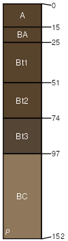
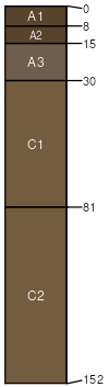
Satanta
(40%)
Loamy Plains
Aridic Argiustolls
Well drained
Hydric: No
PAWS: 26 cm
paleoterraces
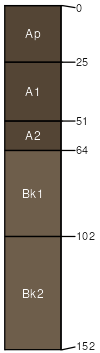
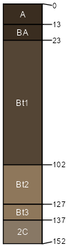
Sampson
(30%)
Loamy Lowland
Pachic Argiustolls
Well drained
Hydric: No
PAWS: 26 cm
flood plains
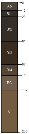
Paoli
(10%)
Sandy Plains
Pachic Haplustolls
Well drained
Hydric: No
PAWS: 21 cm
terraces
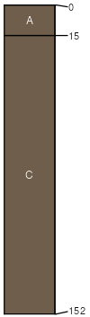
Glenberg
(5%)
Sandy Lowland
Ustic Torrifluvents
Well drained
Hydric: No
PAWS: 17 cm
flood plains
Bankard
(5%)
Sandy Lowland
Ustic Torrifluvents
Somewhat excessively drained
Hydric: No
PAWS: 11 cm
flood plains
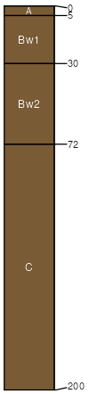
Haverson
(5%)
Loamy Lowland
Aridic Ustifluvents
Well drained
Hydric: No
PAWS: 24 cm
flood plains
Pleasant
(4%)
Closed Upland Depression
Torrertic Argiustolls
Moderately well drained
Hydric: No
PAWS: 27 cm
depressions
Lodgepole
(1%)
Closed Upland Depression
Typic Argiaquolls
Somewhat poorly drained
Hydric: Yes
PAWS: 37 cm
depressions
SSA
Scale
Published
Export
co063
1:24,000
1996
2025-08-29