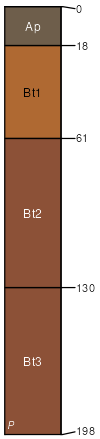
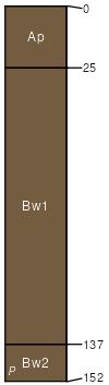
Vertrees silt loam, 12 to 20 percent slopes
Vertrees
(86%)
Deep Well Drained Cherty Uplands
Typic Paleudalfs
Well drained
Hydric: No
PAWS: 24 cm
hills / Shoulder
hills / Backslope
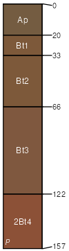
Crider
(4%)
Loess Veneered Uplands
Typic Paleudalfs
Well drained
Hydric: No
PAWS: 24 cm
hills / Summit
hills / Shoulder
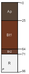
Fredonia
(4%)
Moderately Deep Well Drained Uplands
Typic Hapludalfs
Well drained
Hydric: No
PAWS: 8 cm
hills / Backslope
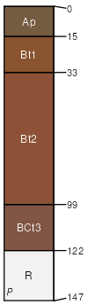
Hagerstown
(4%)
Deep Well Drained Limestone Uplands
Typic Hapludalfs
Well drained
Hydric: No
PAWS: 18 cm
hills / Shoulder
hills / Backslope
Nolin
(2%)
Riverbank Loamy Alluvium
Dystric Fluventic Eutrudepts
Well drained
Hydric: No
PAWS: 46 cm
sinkholes
SSA
Scale
Published
Export
ky621
1:20,000
1975
2025-09-08