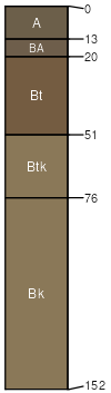
Ulm (65%)
Clayey Foothill
Ustic Haplargids
Well drained
Hydric: No
PAWS: 27 cm |
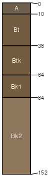
hillslopes / Summit hillslopes / Backslope
|
|
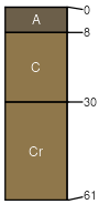
Urban land (20%)
Hydric: No
PAWS: 0 cm |

|
|
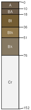
Englewood (3%)
Clayey Foothill
Torrertic Argiustolls
Well drained
Hydric: No
PAWS: NA |
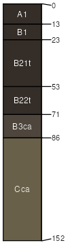
|
|
Nunn (3%)
Clayey Foothill
Aridic Argiustolls
Well drained
Hydric: No
PAWS: NA |
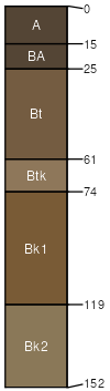
terraces hillslopes / Backslope
|
|
Denver (3%)
Clayey Foothill
Torrertic Argiustolls
Well drained
Hydric: No
PAWS: NA |
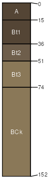
terraces hillslopes / Backslope hillslopes / Footslope
|
|
Manzanola (2%)
Clayey Foothill
Ustic Haplargids
Well drained
Hydric: No
PAWS: NA |
hillslopes / Backslope ridges / Backslope
|
|
Midway (2%)
Shaly Foothill
Ustic Torriorthents
Well drained
Hydric: No
PAWS: NA |
ridges / Summit ridges / Shoulder ridges / Backslope
|
|
Renohill (2%)
Clayey Foothill
Ustic Haplargids
Well drained
Hydric: No
PAWS: NA |
hillslopes / Shoulder hillslopes / Backslope hillslopes / Shoulder hillslopes / Backslope
|
|