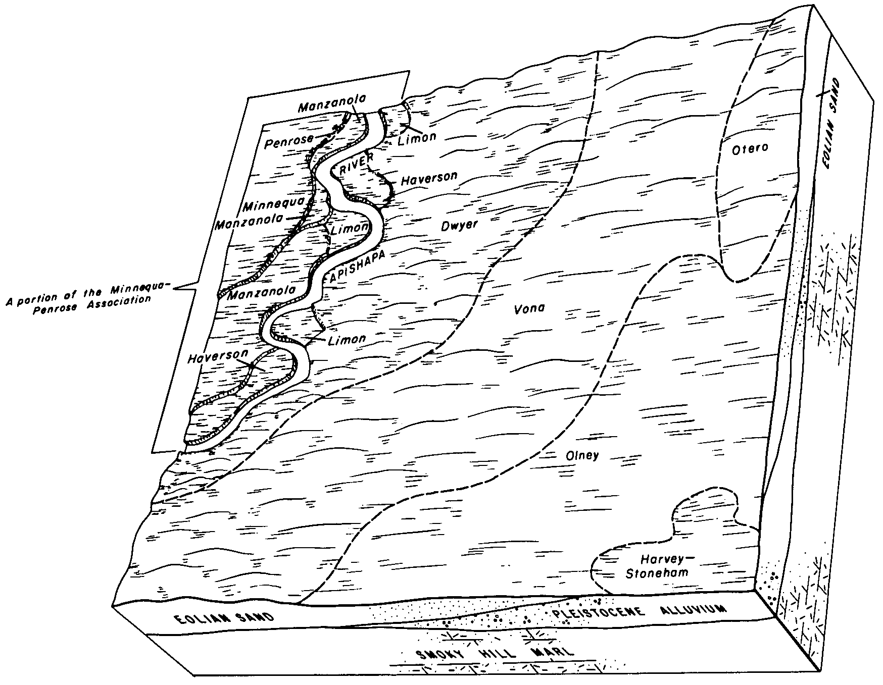
| Manzanola clay loam, dry, 0 to 3 percent slopes | McB | 17464 | 2766547 | 2rgrf | co011 | 1965 | 1:15840 |
Manzanola silty clay loam, 0 to 3 percent slopes | MzB | 5116 | 2766548 | 2rgrj | co011 | 1965 | 1:15840 |
Manzanola clay loam, dry, 0 to 3 percent slopes | McAB | 7915 | 2766550 | 2rgrf | co025 | 1965 | 1:15840 |
Manzanola silty clay loam, 0 to 3 percent slopes | MzB | 3728 | 2766551 | 2rgrj | co025 | 1965 | 1:15840 |
Manzanola silty clay loam, dry, saline, 0 to 2 percent slopes | McA | 2914 | 2766549 | 2rgrd | co025 | 1965 | 1:15840 |
Manzanola silty clay loam, saline, 0 to 2 percent slopes | 24 | 24967 | 2766553 | 2rgrg | co061 | 1977 | 1:24000 |
Manzanola silty clay loam, dry, saline, 0 to 2 percent slopes | MmA | 133 | 2766552 | 2rgrd | co061 | 1977 | 1:24000 |
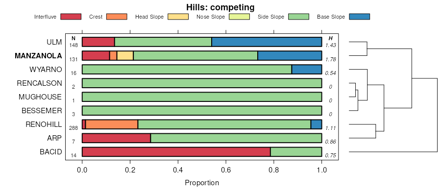
Manzanola clay loam, 1 to 5 percent slopes | 148 | 37124 | 105229 | 3jhh | co073 | 2001 | 1:24000 |
Manzanola clay loam | 66 | 4318 | 94550 | 35d0 | co075 | 1974 | 1:24000 |
Manzanola silty clay loam, dry, saline, 0 to 2 percent slopes | MbA | 37573 | 2766558 | 2rgrd | co089 | 1966 | 1:15840 |
Manzanola clay loam, dry, 0 to 3 percent slopes | McB | 6288 | 2766559 | 2rgrf | co089 | 1966 | 1:15840 |
Manzanola silty clay loam, 0 to 3 percent slopes | MzB | 1076 | 2766560 | 2rgrj | co089 | 1966 | 1:15840 |
Manzanola soils, eroded | Md2 | 286 | 94739 | 35l3 | co089 | 1966 | 1:15840 |
Manzanola clay loam | 44 | 3446 | 95006 | 35vq | co121 | 1982 | 1:24000 |
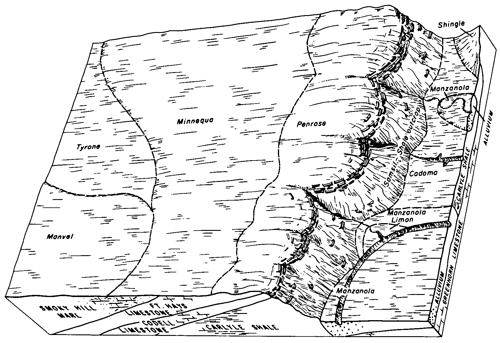
Renohill-Manzanola clay loams, 2 to 5 percent slopes | 63 | 1756 | 95027 | 35wd | co121 | 1982 | 1:24000 |
Manzanola clay loam, 0 to 3 percent slopes | 36 | 14295 | 95128 | 35zn | co617 | 1980 | 1:24000 |
Avar-Manzanola complex, 0 to 3 percent slopes | 10 | 3272 | 95100 | 35yr | co617 | 1980 | 1:24000 |
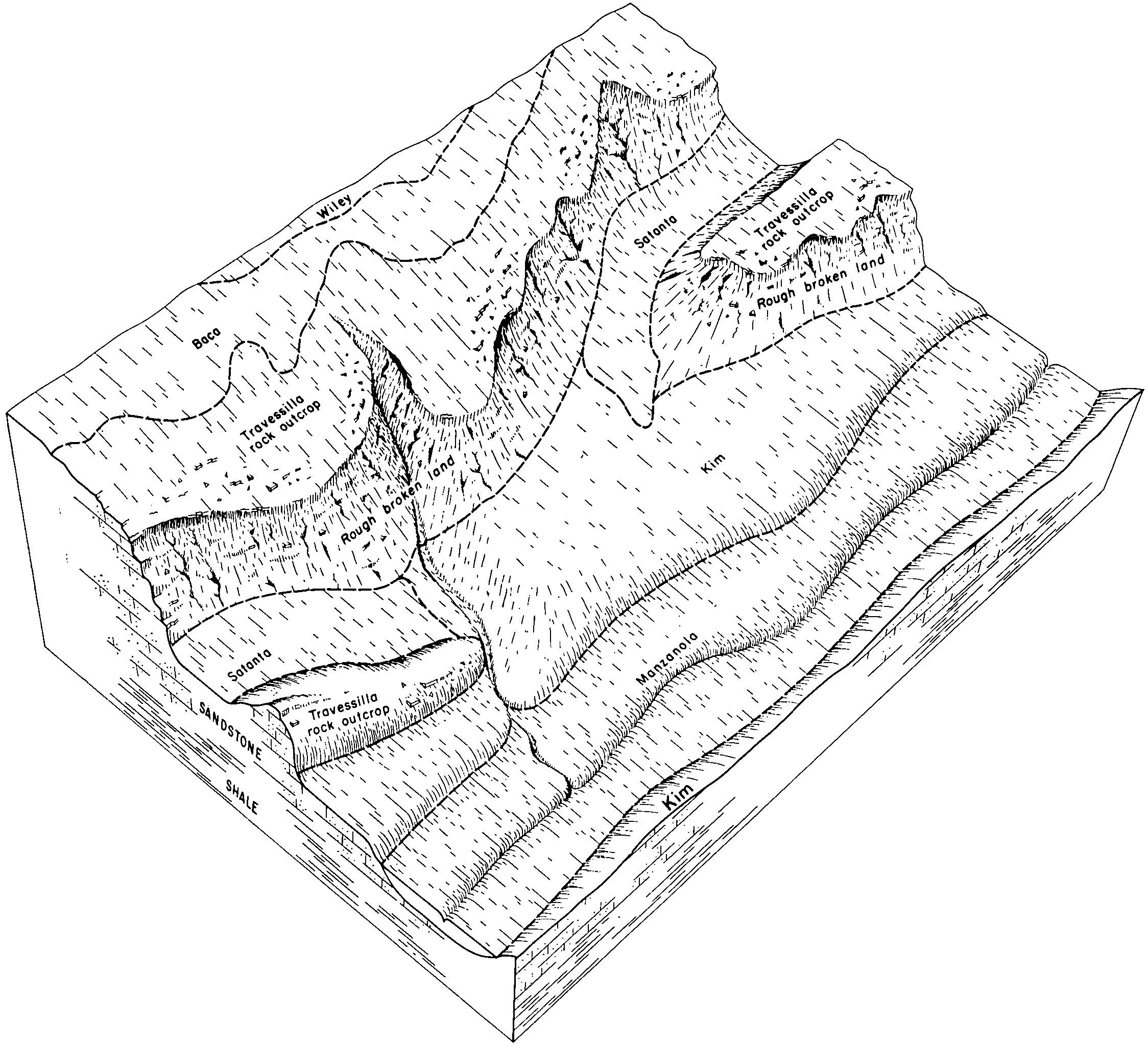
Manzanola clay loam | Ma | 1944 | 498741 | jqzf | co622 | 1968 | 1:20000 |
Renohill-Manzanola clay loams, 3 to 20 percent slopes | RnE | 1708 | 498758 | jqzz | co622 | 1968 | 1:20000 |
Manzanola silty clay loam, saline, 0 to 2 percent slopes | MzA | 5983 | 2766575 | 2rgrg | co625 | 1975 | 1:24000 |
Manzanola clay loam, 3 to 9 percent slopes | 53 | 1137 | 95415 | 368x | co625 | 1975 | 1:24000 |
Manzanola silty clay loam, 3 to 9 percent slopes | MzC | 787 | 2766576 | 2rgrk | co625 | 1975 | 1:24000 |
Manzanola silty clay loam, dry, saline, 0 to 2 percent slopes | MpA | 24038 | 2766562 | 2rgrd | co626 | 1974 | 1:24000 |
Manzanola clay loam, dry, 3 to 9 percent slopes | MoD | 7459 | 2766561 | 2rgrh | co626 | 1974 | 1:24000 |
Manzanola silty clay loam, saline, 0 to 2 percent slopes | MzA | 5916 | 2766564 | 2rgrg | co626 | 1974 | 1:24000 |
Manzanola silty clay loam, 3 to 9 percent slopes | MzC | 4099 | 2766563 | 2rgrk | co626 | 1974 | 1:24000 |
Manzanola silty clay loam, saline, 0 to 2 percent slopes | 44 | 2775 | 2766566 | 2rgrg | co627 | 1980 | 1:24000 |
Manzanola silty clay loam, 3 to 9 percent slopes | MzC | 1487 | 2766568 | 2rgrk | co627 | 1980 | 1:24000 |
Manzanola silty clay loam, 0 to 3 percent slopes | MzB | 75666 | 2766557 | 2rgrj | co628 | 2008 | 1:24000 |
Manzanola silty clay loam, saline, 0 to 2 percent slopes | MzA | 19359 | 2766556 | 2rgrg | co628 | 2008 | 1:24000 |
Manzanola clay loam, dry, 0 to 3 percent slopes | MmB | 2136 | 2766555 | 2rgrf | co628 | 2008 | 1:24000 |
Manzanola silty clay loam, dry, saline, 0 to 2 percent slopes | MmA | 262 | 2766554 | 2rgrd | co628 | 2008 | 1:24000 |
Manzanola loam, 1 to 5 percent slopes | 68 | 3361 | 498336 | jqkc | co637 | 1986 | 1:24000 |
Renohill-Manzanola clay loams, 9 to 15 percent slopes | 133 | 4161 | 497411 | jplj | co641 | 1980 | 1:24000 |
Manzanola-Renohill-Stoneham complex, 9 to 15 percent slopes | 96 | 3286 | 497545 | jpqv | co641 | 1980 | 1:24000 |
Manzanola clay loam, 5 to 9 percent slopes | 92 | 1083 | 497541 | jpqq | co641 | 1980 | 1:24000 |
Manzanola clay loam, 9 to 15 percent slopes | 93 | 818 | 497542 | jpqr | co641 | 1980 | 1:24000 |
Manzanola clay loam, 15 to 25 percent slopes | 94 | 476 | 497543 | jpqs | co641 | 1980 | 1:24000 |
Manzanola clay loam, 0 to 5 percent slopes | 91 | 263 | 497540 | jpqp | co641 | 1980 | 1:24000 |
Manzanola cobbly clay loam, 15 to 25 percent slopes | 95 | 57 | 497544 | jpqt | co641 | 1980 | 1:24000 |
Manzanola silty clay loam, 2 to 6 percent slopes | MbB | 16825 | 355120 | cxjh | sd047 | 1980 | 1:24000 |
Manzanola silty clay loam, 0 to 2 percent slopes | MbA | 4395 | 355119 | cxjg | sd047 | 1980 | 1:24000 |
Manzanola silty clay loam, 0 to 6 percent slopes | 160 | 197 | 349634 | cqtj | wy027 | 1993 | 1:24000 |
Renohill-Manzanola complex, 2 to 20 percent slopes | 5C10 | 3021 | 3358257 | 30zsp | wy617 | | 1:24000 |
Winnett-Manzanola-Cambria-like complex, 1 to 10 percent slopes | 2249 | 467 | 3203034 | 2zbqr | wy629 | | 1:24000 |