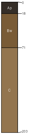
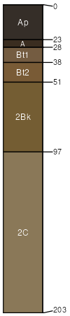
Corliss loamy sand, 12 to 20 percent slopes
Corliss
(90%)
Steep Sandy Upland Forest
Typic Udipsamments
Excessively drained
Hydric: No
PAWS: 8 cm
outwash plains
hillslopes / Summit
hillslopes / Shoulder
hillslopes / Backslope
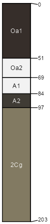
Nidaros
(2%)
Hydric: Yes
PAWS: NA
depressions
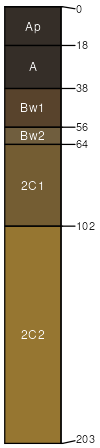
Clontarf
(2%)
Hydric: No
PAWS: NA
Areas with more or less slope
(2%)
Hydric: No
PAWS: NA
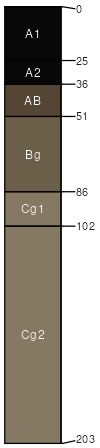
Isan
(2%)
Hydric: Yes
PAWS: NA
swales
flats
Dorset
(1%)
Hydric: No
PAWS: NA
Radium
(1%)
Hydric: No
PAWS: NA
SSA
Scale
Published
Export
mn111
1:20,000
1996
2025-09-10