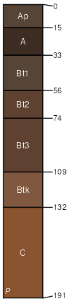
St. Paul clay loam, 3 to 5 percent slopes, moderately eroded
St. Paul
(80%)
Loamy Upland
Pachic Argiustolls
Well drained
Hydric: No
PAWS: 36 cm
paleoterraces
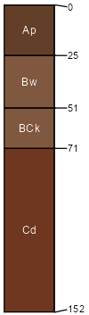
Woodward
(10%)
Loamy Upland
Typic Haplustepts
Well drained
Hydric: No
PAWS: NA
hillslopes / Shoulder
hills
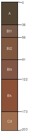
Carey
(8%)
Loamy Upland
Typic Argiustolls
Well drained
Hydric: No
PAWS: NA
hills / Backslope
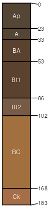
Tipton
(2%)
Loamy Upland
Pachic Argiustolls
Well drained
Hydric: No
PAWS: NA
stream terraces
SSA
Scale
Published
Export
ok043
1:24,000
1961
2025-08-29