| Carey silt loam, 1 to 3 percent slopes | 5412 | 15977 | 1381704 | 2t6pd | ks025 | 1980 | 1:24000 |
Carey silt loam, 0 to 1 percent slopes | 5411 | 15906 | 1381703 | 2t6pb | ks025 | 1980 | 1:24000 |
Carey silt loam, 3 to 5 percent slopes | 5413 | 7592 | 1381705 | 2t6pf | ks025 | 1980 | 1:24000 |
Carey silt loam, 3 to 5 percent slopes | 5413 | 16000 | 1381245 | 2t6pf | ks033 | 1987 | 1:24000 |
Carey silt loam, 0 to 1 percent slopes | 5411 | 6588 | 1381243 | 2t6pb | ks033 | 1987 | 1:24000 |
Carey silt loam, 1 to 3 percent slopes | 5412 | 321 | 1381244 | 2t6pd | ks033 | 1987 | 1:24000 |
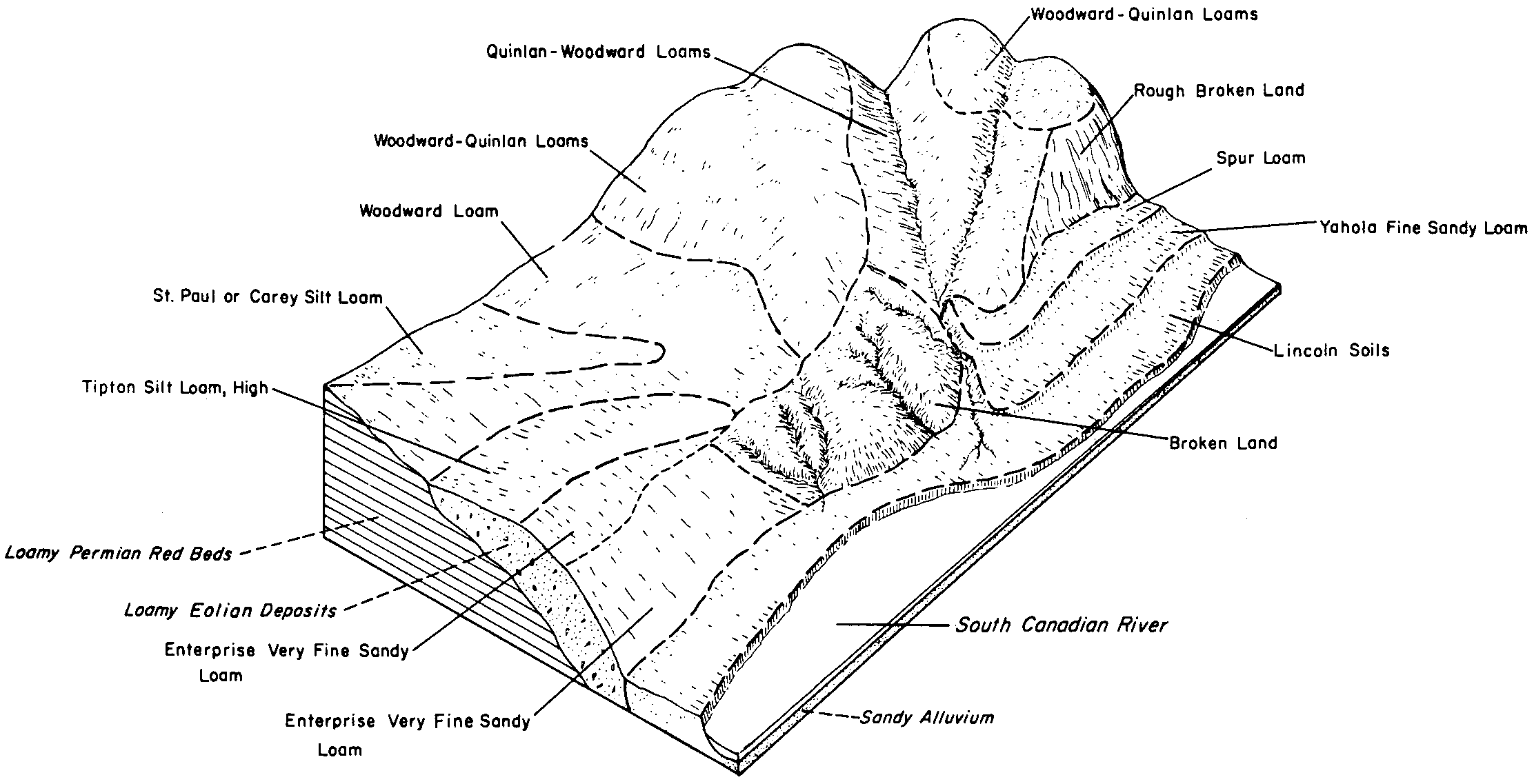
Carey loam, 1 to 3 percent slopes | 7 | 12363 | 381707 | 2t6pl | ok009 | 1978 | 1:24000 |
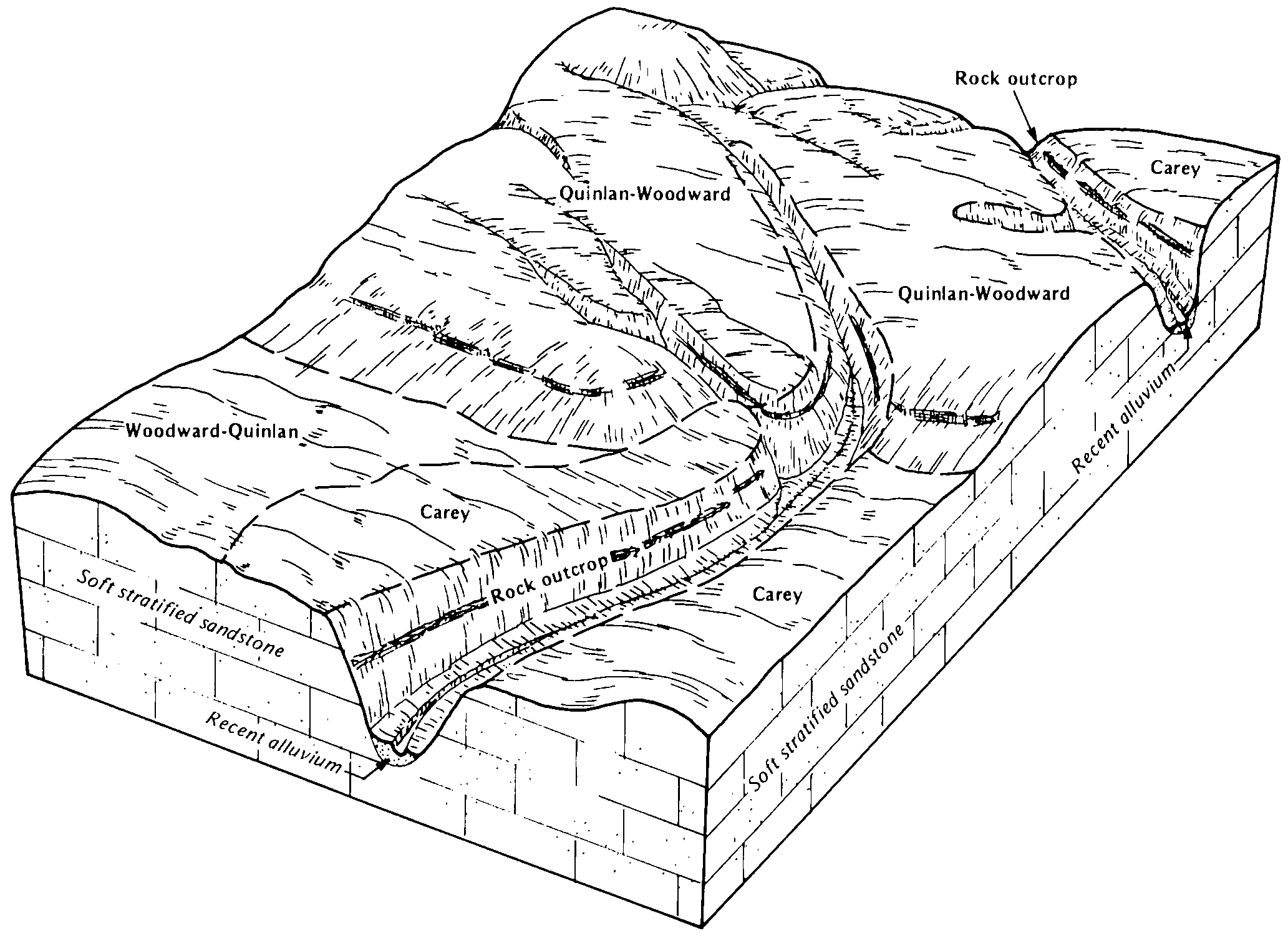
Carey and Woodward soils, 3 to 5 percent slopes | CaC | 45869 | 382310 | dttl | ok039 | 1973 | 1:24000 |
Carey silt loam, 1 to 3 percent slopes | CaB | 44456 | 382309 | 2t6pd | ok039 | 1973 | 1:24000 |
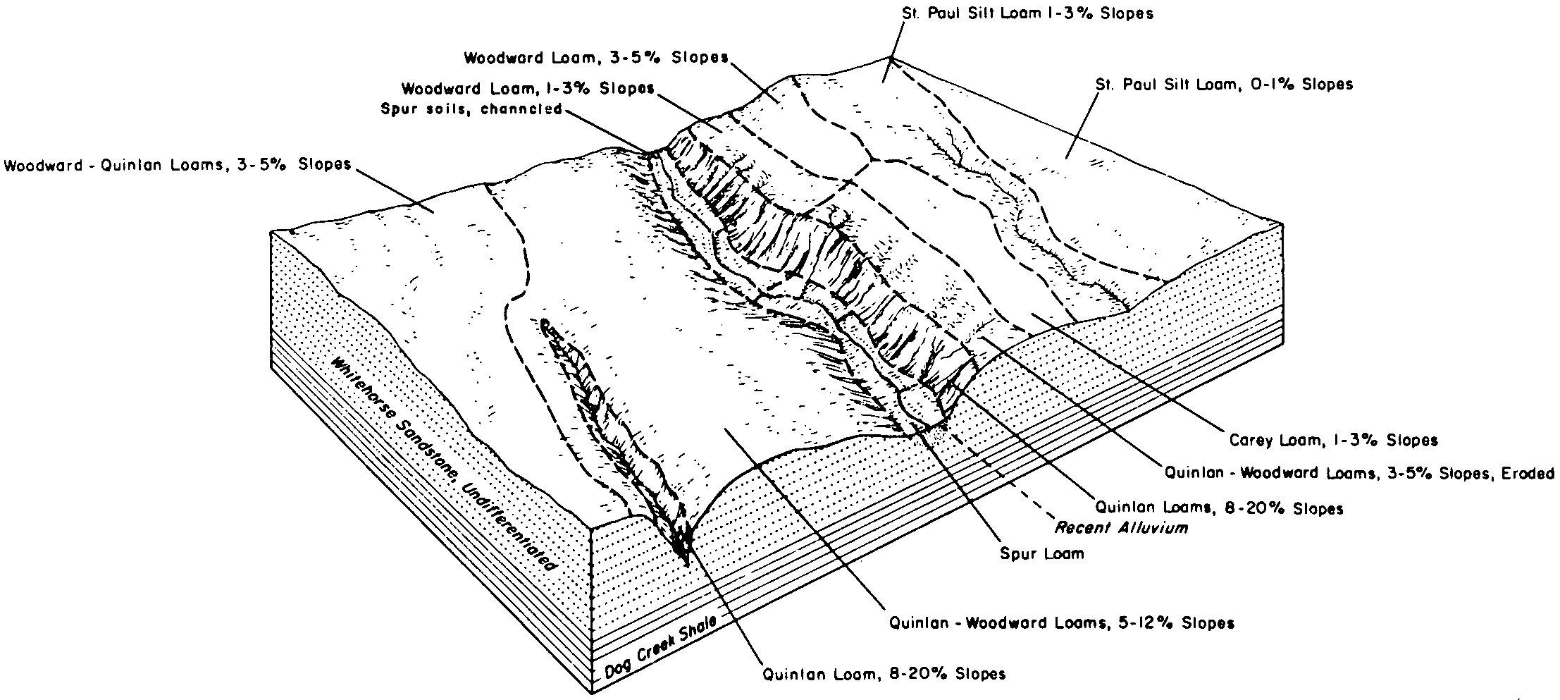
St. Paul and Carey soils, 3 to 5 percent slopes | StC | 27036 | 382344 | dtvp | ok039 | 1973 | 1:24000 |
Carey and Woodward soils, 3 to 5 percent slopes, severely eroded | CbC3 | 1135 | 382311 | dttm | ok039 | 1973 | 1:24000 |
Carey silt loam, 3 to 5 percent slopes | CeC | 31351 | 382358 | 2t6pf | ok043 | 1961 | 1:24000 |
Carey silt loam, 1 to 3 percent slopes | CeB | 16856 | 382357 | 2t6pd | ok043 | 1961 | 1:24000 |
Woodward-Carey complex, 3 to 5 percent slopes, eroded | WcC2 | 8661 | 382410 | dtxt | ok043 | 1961 | 1:24000 |
Carey silt loam, 5 to 8 percent slopes | CeD | 7870 | 382359 | 2t6pg | ok043 | 1961 | 1:24000 |
Woodward-Carey complex, 5 to 8 percent slopes, eroded | WcD2 | 2908 | 382411 | dtxv | ok043 | 1961 | 1:24000 |
Woodward-Carey complex, 1 to 3 percent slopes | WcB | 2026 | 382409 | dtxs | ok043 | 1961 | 1:24000 |
Carey silt loam, 1 to 3 percent slopes | CaB | 2779 | 382423 | 2t6pd | ok045 | 1963 | 1:24000 |
Carey loam, 1 to 3 percent slopes | CarB | 355 | 636640 | 2t6pl | ok055 | 2005 | 1:24000 |
Carey loam, 1 to 3 percent slopes | 11 | 1437 | 975442 | 2t6pl | ok057 | 1982 | 1:24000 |
Carey silt loam, 3 to 5 percent slopes, eroded | CaC2 | 9742 | 383439 | dw00 | ok075 | 1973 | 1:24000 |
Carey silt loam, 3 to 5 percent slopes | CaC | 7835 | 383438 | 2t6pf | ok075 | 1973 | 1:24000 |
Carey-Hinkle complex, 1 to 5 percent slopes | CbD | 5342 | 383440 | dw01 | ok075 | 1973 | 1:24000 |
Carey silt loam, 1 to 3 percent slopes | CaB | 4391 | 383437 | 2t6pd | ok075 | 1973 | 1:24000 |
Carey silt loam, 2 to 8 percent slopes, severely eroded | CeD3 | 1760 | 383441 | dw02 | ok075 | 1973 | 1:24000 |
Carey silt loam, 3 to 5 percent slopes | CrC | 3783 | 383817 | 2t6pf | ok093 | 1965 | 1:24000 |
Carey silt loam, 5 to 8 percent slopes, eroded | CrD2 | 2576 | 383818 | 2t6pk | ok093 | 1965 | 1:24000 |
Carey silt loam, 1 to 3 percent slopes | CrB | 2483 | 383816 | 2t6pd | ok093 | 1965 | 1:24000 |
Carey silt loam, 1 to 3 percent slopes | CaB | 3355 | 384727 | 2t6pd | ok129 | 1961 | 1:24000 |
Carey silt loam, 3 to 5 percent slopes | CaC | 747 | 384728 | 2t6pf | ok129 | 1961 | 1:24000 |
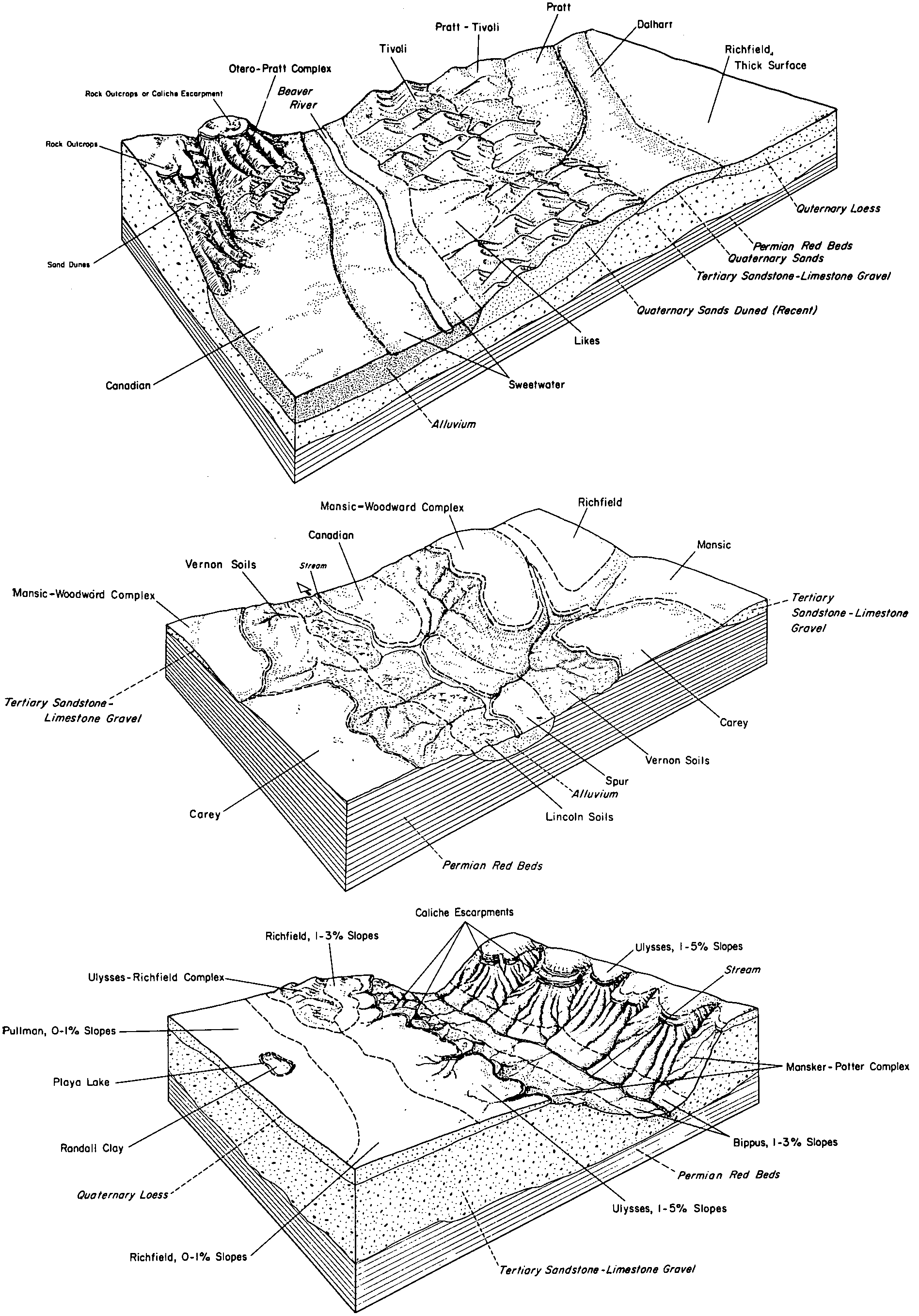
Carey silt loam, 3 to 5 percent slopes | 8 | 37346 | 385046 | 2t6pf | ok149 | 1976 | 1:24000 |
Carey silt loam, 1 to 3 percent slopes | 7 | 35738 | 385045 | 2t6pd | ok149 | 1976 | 1:24000 |
Carey silt loam, 1 to 3 percent slopes | CaB | 21981 | 385263 | 2t6pd | ok153 | 1961 | 1:24000 |
Carey silt loam, 3 to 5 percent slopes | CaC | 18764 | 385264 | 2t6pf | ok153 | 1961 | 1:24000 |
Carey silt loam, 5 to 8 percent slopes, eroded | CaD2 | 4362 | 385266 | 2t6pk | ok153 | 1961 | 1:24000 |
Carey silt loam, 5 to 8 percent slopes | CaD | 1030 | 385265 | 2t6pg | ok153 | 1961 | 1:24000 |
Carey loam, 1 to 3 percent slopes | CaB | 42560 | 363811 | 2t6pl | tx075 | 1961 | 1:20000 |
Carey loam, 1 to 3 percent slopes | CaB | 17987 | 364096 | 2t6pl | tx087 | 1965 | 1:20000 |
Carey loam, 0 to 1 percent slopes | CaA | 4933 | 364095 | 2t6pj | tx087 | 1965 | 1:20000 |
Carey loam, 3 to 5 percent slopes | CaC | 2058 | 364097 | 2t6pm | tx087 | 1965 | 1:20000 |
Carey loam, 1 to 3 percent slopes | CaB | 13790 | 364579 | 2t6pl | tx101 | 1969 | 1:20000 |
Carey loam, 0 to 1 percent slopes | CaA | 972 | 364578 | 2wt7c | tx101 | 1969 | 1:20000 |
Carey loam, 1 to 3 percent slopes | CaB | 2873 | 365113 | 2t6pl | tx125 | 1965 | 1:20000 |
Carey loam, 3 to 5 percent slopes | CaC | 2245 | 365114 | 2t6pm | tx125 | 1965 | 1:20000 |
Carey loam, 1 to 3 percent slopes | CaB | 2213 | 365167 | 2t6pl | tx129 | 1975 | 1:24000 |
Carey loam, 0 to 1 percent slopes | CaA | 211 | 365166 | 2t6pj | tx129 | 1975 | 1:24000 |
Carey loam, 1 to 3 percent slopes | CaB | 21809 | 366929 | 2t6pl | tx191 | 1965 | 1:20000 |
Carey loam, 3 to 5 percent slopes | CaC | 6622 | 366930 | 2t6pm | tx191 | 1965 | 1:20000 |
Carey loam, 1 to 3 percent slopes | CaB | 31443 | 368602 | 2t6pl | tx269 | 1999 | 1:31680 |
Carey loam, 0 to 1 percent slopes | CaA | 11368 | 368575 | 2wt7c | tx269 | 1999 | 1:31680 |
Carey silt loam, 1 to 3 percent slopes | CaB | 10503 | 373284 | 2t6pd | tx483 | 1970 | 1:24000 |
Carey silt loam, 0 to 1 percent slopes | CaA | 579 | 373283 | 2t6pb | tx483 | 1970 | 1:24000 |