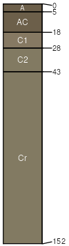
Samsil (55%)
Shallow Clay
Aridic Ustorthents
Well drained
Hydric: No
PAWS: 5 cm |
hills / Summit hills / Shoulder
|
|
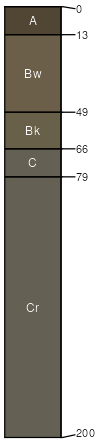
Rock outcrop (30%)
Non-site
Well drained
Hydric: No
PAWS: 2 cm |

|
|
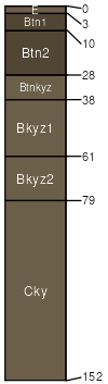
Pierre (4%)
Clayey
Torrertic Haplustepts
Well drained
Hydric: No
PAWS: 11 cm |
|
|
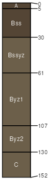
Capa (4%)
Thin Claypan
Leptic Vertic Natrustolls
Moderately well drained
Hydric: No
PAWS: 15 cm |
|
|
Bullcreek (4%)
Dense Clay
Typic Haplusterts
Well drained
Hydric: No
PAWS: 16 cm |
|
|
Schamber (3%)
Very Shallow
Aridic Ustorthents
Excessively drained
Hydric: No
PAWS: 17 cm |
|
|