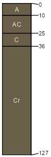
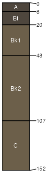
Sansarc (60%)
Shallow Clay
Typic Ustorthents
Well drained
Hydric: No
PAWS: 4 cm |
valley sides / Shoulder valley sides / Backslope
|
|
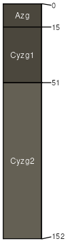
Gettys (30%)
Thin Upland
Vertic Ustorthents
Well drained
Hydric: No
PAWS: 22 cm |
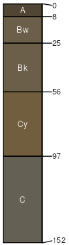
ridges / Shoulder ridges / Backslope
|
|
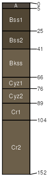
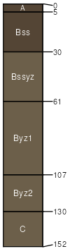
Opal (3%)
Clayey
Leptic Udic Haplusterts
Well drained
Hydric: No
PAWS: 8 cm |
hills / Backslope hills / Footslope
|
|
Lakoma (3%)
Thin Upland
Typic Ustochrepts
Well drained
Hydric: No
PAWS: 7 cm |
|
|
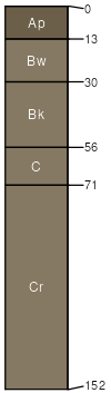
Peno (2%)
Clayey
Vertic Argiustolls
Well drained
Hydric: No
PAWS: 23 cm |
valley sides / Shoulder valley sides / Backslope
|
|
Herdcamp (1%)
Wet Land
Vertic Endoaquolls
Very poorly drained
Hydric: Yes
PAWS: 22 cm |
|
|
Bullcreek (1%)
Dense Clay
Udic Chromusterts
Well drained
Hydric: No
PAWS: 16 cm |
|
|