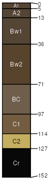
Snomo (55%)
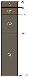
Shallow Porous Clay
Ustollic Camborthids
Well drained
Hydric: No
PAWS: 14 cm |
plains / Summit plains / Backslope
|
|
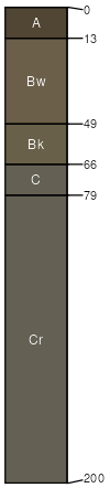
Rock outcrop (30%)
Non-site
Excessively drained
Hydric: No
PAWS: 20 cm |

|
|
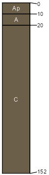
Lohmiller (3%)
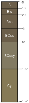
Loamy Overflow
Ustic Torrifluvents
Well drained
Hydric: No
PAWS: 23 cm |
|
|
Pierre (3%)
Clayey 16-18 P.Z.
Aridic Haplusterts
Well drained
Hydric: No
PAWS: 7 cm |
plains / Summit plains / Backslope
|
|
Graner (3%)
Porous Clay
Ustic Torriorthents
Well drained
Hydric: No
PAWS: 15 cm |
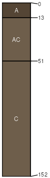
dunes / Backslope dunes / Footslope
|
|
Grummit (3%)
Shallow Clay
Ustic Torriorthents
Well drained
Hydric: No
PAWS: 6 cm |
ridges / Shoulder ridges / Backslope
|
|
Kyle (3%)
Clayey 16-18 P.Z.
Aridic Haplusterts
Well drained
Hydric: No
PAWS: 15 cm |
plains / Backslope plains / Footslope
|
|