Sandbranch taxadjunct-Cumberhill-Poposhia complex, 4 to 15 percent slopes
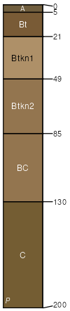
Sandbranch taxadjunct
(35%)
Saline Upland Green River and Great Divide Basins (SU)
Ustic Natrargids
Well drained
Hydric: No
PAWS: 33 cm
hillslopes / Backslope
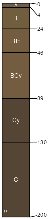
Cumberhill
(30%)
Saline Upland Green River and Great Divide Basins (SU)
Ustic Natrigypsids
Well drained
Hydric: No
PAWS: 35 cm
hillslopes / Backslope
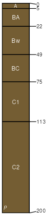
Poposhia
(20%)
Limy Pinedale Plateau (Li PP)
Ustic Haplocambids
Well drained
Hydric: No
PAWS: 36 cm
hillslopes / Summit
hillslopes / Shoulder
hillslopes / Backslope
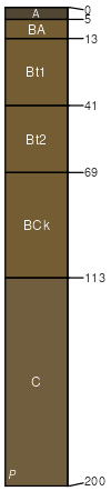
Forelle
(10%)
Loamy Green River and Great Divide Basins (Ly)
Ustic Haplargids
Well drained
Hydric: No
PAWS: 36 cm
hillslopes / Backslope
Rock outcrop
(5%)
Hydric: No
PAWS: NA
SSA
Scale
Published
Export
wy723
1:24,000
2025-09-04