Latham-Wharton silt loams, 15 to 25 percent slopes, eroded
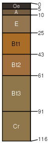
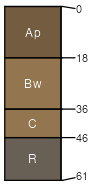
Latham
(45%)
Acid Mixed Sedimentary Upland
Aquic Hapludults
Moderately well drained
Hydric: No
PAWS: 12 cm
hills / Backslope
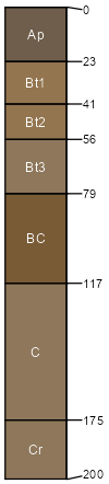
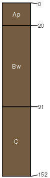
Wharton
(35%)
Acid Mixed Sedimentary Upland
Aquic Hapludults
Moderately well drained
Hydric: No
PAWS: 21 cm
hills / Backslope
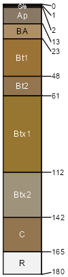
Tilsit
(5%)
Typic Fragiudults
Moderately well drained
Hydric: No
PAWS: 21 cm
hills / Summit
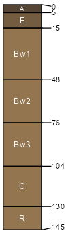
Brownsville
(5%)
Typic Dystrudepts
Well drained
Hydric: No
PAWS: 16 cm
hills / Backslope
Weikert
(5%)
Lithic Dystrudepts
Somewhat excessively drained
Hydric: No
PAWS: 5 cm
hills / Backslope
Clifty
(5%)
Fluventic Dystrudepts
Well drained
Hydric: No
PAWS: 21 cm
flood plains
SSA
Scale
Published
Export
oh163
1:16,000
1998
2025-09-08