Shingle (45%)
Shallow Loamy (SwLy) 10-14 PZ
Ustic Torriorthents
Well drained
Hydric: No
PAWS: 7 cm |
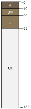
hills / Summit hills / Shoulder ridges / Summit ridges / Shoulder
|
|
Haverdad (35%)
Overflow (Ov) 10-14 PZ
Ustic Torrifluvents
Well drained
Hydric: No
PAWS: 23 cm |
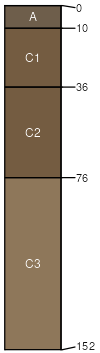
stream terraces flood plains
|
|
Draknab (8%)
Lowland (LL) 10-14 PZ
Ustic Torrifluvents
Excessively drained
Hydric: No
PAWS: 13 cm |
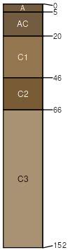
stream terraces flood plains
|
|
Samday (7%)
Shallow Clayey (SwCy) 10-14 PZ
Ustic Torriorthents
Well drained
Hydric: No
PAWS: 6 cm |
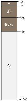
ridges / Summit ridges / Shoulder hills / Summit hills / Shoulder
|
|
Badland (5%)
Hydric: No
PAWS: NA |

|
|