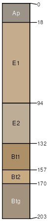
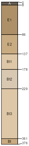
Blanton sand, 0 to 5 percent slopes
Blanton
(80%)
Summits, Loamy, Thick Sandy Surface
Grossarenic Paleudults
Well drained
Hydric: No
PAWS: 12 cm
interfluves / Shoulder
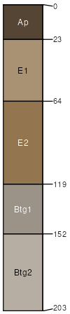
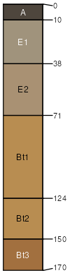
Albany
(5%)
Summits, Loamy and Clayey, Seasonally Wet
Aquic Arenic Paleudults
Somewhat poorly drained
Hydric: No
PAWS: 16 cm
interfluves / Shoulder
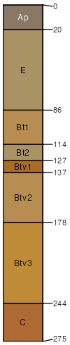
Fuquay
(5%)
Summits, Loamy, Thick Sandy Surface
Arenic Plinthic Kandiudults
Well drained
Hydric: No
PAWS: 17 cm
interfluves / Shoulder
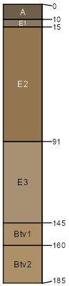
Bonifay
(4%)
Summits, Loamy, Thick Sandy Surface
Grossarenic Plinthic Paleudults
Well drained
Hydric: No
PAWS: 20 cm
ridges / Summit
Alpin
(3%)
Sandy Upland, Dry Summits
Lamellic Quartzipsamments
Excessively drained
Hydric: No
PAWS: 13 cm
ridges / Summit
Ocilla
(3%)
Summits, Loamy and Clayey, Seasonally Wet
Aquic Arenic Paleudults
Somewhat poorly drained
Hydric: No
PAWS: 22 cm
stream terraces / Toeslope
SSA
Scale
Published
Export
fl079
1:16,000
1988
2025-08-27