Official Series Description


Lab Data Summary

Aggregate lab data for the NEVEE soil series. This aggregation is based on all pedons with a current taxon name of NEVEE, and applied along 1-cm thick depth slices. Solid lines are the slice-wise median, bounded on either side by the interval defined by the slice-wise 5th and 95th percentiles. The median is the value that splits the data in half. Five percent of the data are less than the 5th percentile, and five percent of the data are greater than the 95th percentile. Values along the right hand side y-axis describe the proportion of pedon data that contribute to aggregate values at this depth. For example, a value of "90%" at 25cm means that 90% of the pedons correlated to NEVEE were used in the calculation. Source: KSSL snapshot . Methods used to assemble the KSSL snapshot used by SoilWeb / SDE

Click the image to view it full size.

Pedons used in the lab summary:

MLRALab IDPedon IDTaxonnameCINSSL / NASIS ReportsLink To SoilWeb GMap
6140A2427S1970SD019007NEVEE7Primary | Supplementary | Taxonomy | Pedon | Water Retention | Correlation | Andic Soil Properties44.586113,-104.0166702

Water Balance

Monthly water balance estimated using a leaky-bucket style model for the NEVEE soil series. Monthly precipitation (PPT) and potential evapotranspiration (PET) have been estimated from the 50th percentile of gridded values (PRISM 1981-2010) overlapping with the extent of SSURGO map units containing each series as a major component. Monthly PET values were estimated using the method of Thornthwaite (1948). These (and other) climatic parameters are calculated with each SSURGO refresh and provided by the fetchOSD function of the soilDB package. Representative water storage values (“AWC” in the figures) were derived from SSURGO by taking the 50th percentile of profile-total water storage (sum[awc_r * horizon thickness]) for each soil series. Note that this representation of “water storage” is based on the average ability of most plants to extract soil water between 15 bar (“permanent wilting point”) and 1/3 bar (“field capacity”) matric potential. Soil moisture state can be roughly interpreted as “dry” when storage is depleted, “moist” when storage is between 0mm and AWC, and “wet” when there is a surplus. Clearly there are a lot of assumptions baked into this kind of monthly water balance. This is still a work in progress.

Click the image to view it full size.


Click the image to view it full size.

Sibling Summary

Siblings are those soil series that occur together in map units, in this case with the NEVEE series. Sketches are arranged according to their subgroup-level taxonomic structure. Source: SSURGO snapshot , parsed OSD records and snapshot of SC database .

Click the image to view it full size.

Select annual climate data summaries for the NEVEE series and siblings. Series are sorted according to hierarchical clustering of median values. Source: SSURGO map unit geometry and 1981-2010, 800m PRISM data .

Click the image to view it full size.

Geomorphic description summaries for the NEVEE series and siblings. Series are sorted according to hierarchical clustering of proportions and relative hydrologic position within an idealized landform (e.g. top to bottom). Most soil series (SSURGO components) are associated with a hillslope position and one or more landform-specific positions: hills, mountain slopes, terraces, and/or flats. Proportions can be interpreted as an aggregate representation of geomorphic membership. The values printed to the left (number of component records) and right (Shannon entropy) of stacked bars can be used to judge the reliability of trends. Small Shannon entropy values suggest relatively consistent geomorphic association, while larger values suggest lack thereof. Source: SSURGO component records .

Click the image to view it full size.

Click the image to view it full size.

Click the image to view it full size.

Click the image to view it full size.

Click the image to view it full size.

Competing Series

Soil series competing with NEVEE share the same family level classification in Soil Taxonomy. Source: parsed OSD records and snapshot of the SC database .

Click the image to view it full size.

Select annual climate data summaries for the NEVEE series and competing. Series are sorted according to hierarchical clustering of median values. Source: SSURGO map unit geometry and 1981-2010, 800m PRISM data .

Click the image to view it full size.

Geomorphic description summaries for the NEVEE series and competing. Series are sorted according to hierarchical clustering of proportions and relative hydrologic position within an idealized landform (e.g. top to bottom). Proportions can be interpreted as an aggregate representation of geomorphic membership. Most soil series (SSURGO components) are associated with a hillslope position and one or more landform-specific positions: hills, mountain slopes, terraces, and/or flats. The values printed to the left (number of component records) and right (Shannon entropy) of stacked bars can be used to judge the reliability of trends. Shannon entropy values close to 0 represent soil series with relatively consistent geomorphic association, while values close to 1 suggest lack thereof. Source: SSURGO component records .

Click the image to view it full size.

Click the image to view it full size.

There are insufficient data to create the 3D mountains figure.

Click the image to view it full size.

There are insufficient data to create the 3D flats position figure.

Soil series sharing subgroup-level classification with NEVEE, arranged according to family differentiae. Hovering over a series name will print full classification and a small sketch from the OSD. Source: snapshot of SC database .

Block Diagrams

No block diagrams are available.

Map Units

Map units containing NEVEE as a major component. Limited to 250 records.

Map Unit Name Symbol Map Unit Area (ac) Map Unit Key National Map Unit Symbol Soil Survey Area Publication Date Map Scale
Nevee silt loam, 2 to 6 percent slopesP246B94226688812rvdzsd01919701:24000
Nevee-Spearfish silt loams, 6 to 20 percent slopesP256D79627680942rvf5sd01919701:24000
Nevee silt loam, 6 to 10 percent slopesP246C127680932rvf0sd01919701:24000
Nevee silt loam, dry, 6 to 15 percent slopesP250D141327331382rvf2sd04719801:24000
Spearfish-Nevee silt loams, dry, 9 to 30 percent slopesP476E6527681072rxsgsd04719801:24000
Nevee-Spearfish silt loams, 6 to 20 percent slopesP256D374127332592rvf5sd08120071:24000
Nevee-Tilford silt loams, 3 to 10 percent slopesP262C370827332612rvf7sd08120071:24000
Nevee silt loam, 2 to 6 percent slopesP246B233427332562rvdzsd08120071:24000
Nevee silt loam, 6 to 10 percent slopesP246C218827332572rvf0sd08120071:24000
Nevee-Spearfish silt loams, very stony, 10 to 40 percent slopesP258E196327332602rvf6sd08120071:24000
Nevee-Nihill, moderately deep complex, 10 to 50 percent slopesP254F142727332582rvf4sd08120071:24000
Tilford-Nevee silt loams, 1 to 4 percent slopesP520B135627332762s02hsd08120071:24000
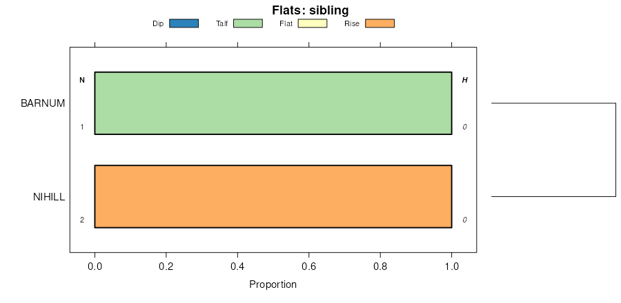
Barnum, moist, occasionally flooded-Tilford-Nevee silt loams, 1 to 25 percent slopesP032E105427332902qt21sd08120071:24000
Spearfish-Nevee-Gullied land complex, 6 to 30 percent slopesP478E69127332692rxvrsd08120071:24000
Nevee-Spearfish silt loams, 6 to 20 percent slopesP256D336727334282rvf5sd60019741:24000
Nevee-Spearfish complex, 6 to 15 percent slopesNaD100354332cwq2sd60019741:24000
Nevee-Tilford silt loams, 3 to 10 percent slopesP262C3527681162rvf7sd60019741:24000
Nevee silt loam, dry, 2 to 9 percent slopesP250C883927456692rvf1sd60720111:24000
Nevee, dry-Gullied land complex, 6 to 40 percent slopesP252E480127456702rvf3sd60720111:24000
Spearfish-Nevee silt loams, dry, 9 to 30 percent slopesP476E222327456922rxsgsd60720111:24000
Nevee-Spearfish silt loams, 6 to 20 percent slopesP256D140527681402rvf5sd60720111:24000
Nevee channery loam, dry, 6 to 15 percent slopesP244D113627456682rvdysd60720111:24000
Nevee silt loam, 2 to 6 percent slopesP246B23427681372rvdzsd60720111:24000
Nevee silt loam, 6 to 10 percent slopesP246C20727681382rvf0sd60720111:24000
Nevee-Nihill, moderately deep complex, 10 to 50 percent slopesP254F6127681392rvf4sd60720111:24000
Nevee silt loam, 6 to 10 percent slopes, erodedP248C1485327457692rvdmwy01119781:24000
Nevee silt loam, 6 to 10 percent slopesP246C500527457682rvf0wy01119781:24000
Nevee silt loam, 10 to 30 percent slopes, erodedP248E377027457712rvdnwy01119781:24000
Nevee silt loam, 1 to 6 percent slopes, erodedP248B310327457672rvdlwy01119781:24000
Spearfish-Nevee-Gullied land complex, 6 to 30 percent slopesP478E292027457372rxvrwy01119781:24000
Nevee silt loam, 2 to 6 percent slopesP246B210227457662rvdzwy01119781:24000
Nevee-Spearfish-Barnum, channeled, flooded complex, 2 to 40 percent slopesP260E169727457362rvf9wy01119781:24000
Nevee silt loam, 10 to 15 percent slopesP246D116227457702rxs5wy01119781:24000
Nevee-Tilford silt loams, 3 to 10 percent slopesP262C10727459502rvf7wy01119781:24000
Nevee-Spearfish silt loams, 6 to 20 percent slopesP256D5427459482rvf5wy01119781:24000
Tilford-Nevee silt loams, 1 to 4 percent slopesP520B4227459522s02hwy01119781:24000
Nevee-Spearfish silt loams, very stony, 10 to 40 percent slopesP258E3127459492rvf6wy01119781:24000
Nevee-Spearfish-Barnum, channeled, flooded complex, 2 to 40 percent slopesP260E30027459812rvf9wy04519841:24000
Nevee silt loam, dry, 2 to 9 percent slopesP250C227681972rvf1wy04519841:24000

Map of Series Extent

Approximate geographic distribution of the NEVEE soil series. To learn more about how this distribution was mapped, or to compare this soil series extent to others, use the Series Extent Explorer (SEE) application. Source: generalization of SSURGO geometry .