Gilcrest sandy loam, 0 to 2 percent slopes
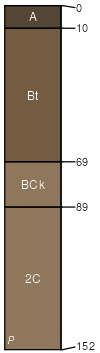
Gilcrest
(90%)
Sandy Plains
Ustic Haplargids
Somewhat excessively drained
Hydric: No
PAWS: 14 cm
terraces
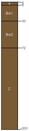
Bankard
(10%)
Sandy Bottomland
Ustic Torripsamments
Excessively drained
Hydric: No
PAWS: 11 cm
flood plains
SSA
Scale
Published
Export
co626
1:24,000
1974
2025-08-29