Bankard-Glenberg complex, 0 to 2 percent slopes, occasionally flooded
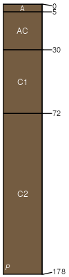
Bankard
(45%)
Sandy Bottomland
Ustic Torrifluvents
Excessively drained
Hydric: No
PAWS: 11 cm
flood plains
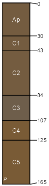
Glenberg
(40%)
Sandy Bottomland
Ustic Torrifluvents
Somewhat excessively drained
Hydric: No
PAWS: 17 cm
flood plains
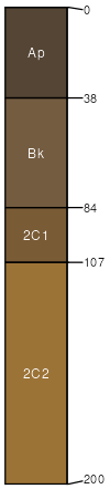
Bentfort
(10%)
Salt Meadow
Oxyaquic Haplustolls
Moderately well drained
Hydric: No
PAWS: 22 cm
flood plains / Toeslope
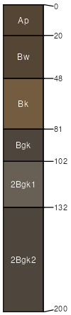
Cheraw
(5%)
Salt Meadow
Fluvaquentic Haplustolls
Moderately well drained
Hydric: No
PAWS: 36 cm
flood-plain steps
SSA
Scale
Published
Export
co061
1:24,000
1977
2025-08-29