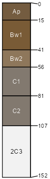
Buchanan (85%)
Convergent Uplands
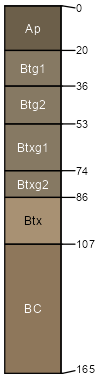
Aquic Fragiudults
Moderately well drained
Hydric: No
PAWS: 21 cm |
hillslopes / Footslope hillslopes / Toeslope
|
|
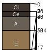
Hartleton (6%)
Typic Hapludults
Well drained
Hydric: No
PAWS: 12 cm |
hills / Backslope ridges / Backslope
|
|
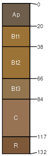
Portville (5%)
Convergent Uplands
Aeric Fragiaqualfs
Somewhat poorly drained
Hydric: No
PAWS: 12 cm |
|
|
|
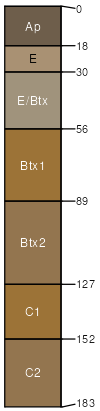
Brinkerton (1%)
Typic Fragiaqualfs
Poorly drained
Hydric: Yes
PAWS: 23 cm |
|
|