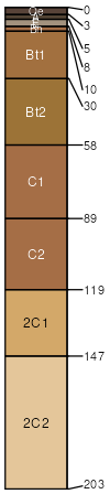
Swainton sandy loam, 2 to 5 percent slopes
Swainton
(90%)
Well Drained Coarse-Loamy Upland
Typic Hapludults
Well drained
Hydric: No
PAWS: 20 cm
interfluves
low hills
ridges / Summit
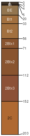
Aura
(4%)
Well Drained Coarse-Loamy Upland
Typic Fragiudults
Well drained
Hydric: No
PAWS: 21 cm
low hills
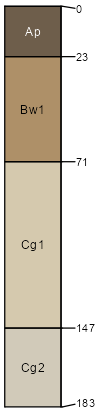
Galloway
(3%)
Moist Sandy Upland
Aquic Quartzipsamments
Moderately well drained
Hydric: No
PAWS: 13 cm
flats
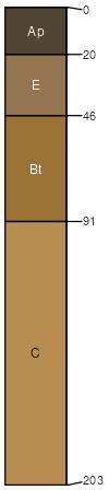
Hammonton
(3%)
Moist Loamy Upland
Aquic Hapludults
Moderately well drained
Hydric: No
PAWS: 22 cm
flats
depressions / Toeslope
SSA
Scale
Published
Export
nj009
1:24,000
1997
2025-08-28