Tohona-Kimnoli-Claysprings complex, 2 to 45 percent slopes
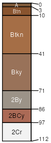
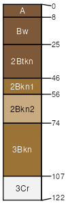
Tohona
(50%)
Clay Loam Upland 6-10 p.z. Sodic
Vertic Natrigypsids
Well drained
Hydric: No
PAWS: 10 cm
cuestas / Backslope
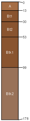
Kimnoli
(20%)
Sandstone Upland 6-10 p.z.
Lithic Haplargids
Well drained
Hydric: No
PAWS: 3 cm
benches
Claysprings
(15%)
Clayey Slopes 6-10 p.z. Bouldery
Typic Torriorthents
Well drained
Hydric: No
PAWS: 5 cm
cuestas / Backslope
Riverwash
(5%)
Somewhat excessively drained
Hydric: No
PAWS: 7 cm
channels
Badland
(4%)
Hydric: No
PAWS: NA
hills / Backslope
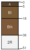
Sheppard
(2%)
Sandy Upland 6-10
Typic Torripsamments
Somewhat excessively drained
Hydric: No
PAWS: 12 cm
cuestas
mesas
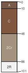
Kimbeto
(2%)
Colluvial Slopes 6-10 p.z. Warm
Typic Calciargids
Well drained
Hydric: No
PAWS: 12 cm
hills / Summit
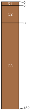
Sogzie
(2%)
Sandy Loam Upland 6-10
Typic Calciargids
Well drained
Hydric: No
PAWS: 25 cm
cuestas
mesas
SSA
Scale
Published
Export
nm717
1:24,000
1993
2025-09-09