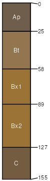
Washington (90%)
Mixed Limestone Upland
Ultic Hapludalfs
Well drained
Hydric: No
PAWS: 26 cm |
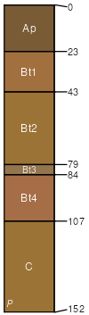
valleys / Shoulder valleys / Backslope
|
|
Clarksburg (5%)
Oxyaquic Fragiudalfs
Moderately well drained
Hydric: No
PAWS: 25 cm |
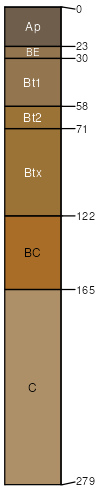
valley flats / Footslope valley flats / Toeslope
|
|
Ryder (3%)
Ultic Hapludalfs
Well drained
Hydric: No
PAWS: 32 cm |
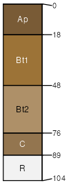
hills / Summit hills / Shoulder hills / Backslope
|
|
Thorndale (1%)
Typic Fragiaqualfs
Poorly drained
Hydric: Yes
PAWS: 19 cm |
|
|
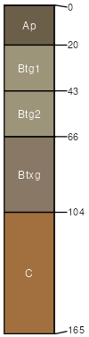
Penlaw (1%)
Aquic Fragiudalfs
Somewhat poorly drained
Hydric: No
PAWS: 27 cm |
swales / Footslope swales / Toeslope
|
|