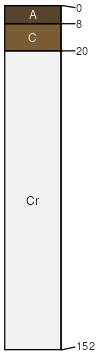
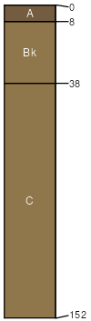
Highpoint-Rock outcrop complex, steep
Highpoint
(45%)
Shallow Clayey High Plains Southeast (SwCy)
Ustic Torriorthents
Well drained
Hydric: No
PAWS: 2 cm
ridges
hills
Rock outcrop
(35%)
Hydric: No
PAWS: NA
hills
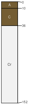
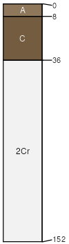
Blazon
(4%)
Shallow Clayey High Plains Southeast (SwCy)
Ustic Torriorthents
Well drained
Hydric: No
PAWS: 10 cm
hills
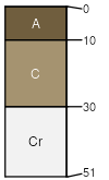
Carmody
(4%)
Sandy High Plains Southeast (Sy)
Ustic Torriorthents
Well drained
Hydric: No
PAWS: 8 cm
hillslopes
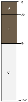
Blackhall
(4%)
Shallow Sandy High Plains Southeast (SwSy)
Ustic Torriorthents
Well drained
Hydric: No
PAWS: 6 cm
ridges
hills
Poposhia
(4%)
Clayey High Plains Southeast (Cy)
Ustic Haplocambids
Well drained
Hydric: No
PAWS: 23 cm
fan aprons
Cragosen
(4%)
Shallow Loamy High Plains Southeast (SwLy)
Ustic Torriorthents
Well drained
Hydric: No
PAWS: 3 cm
hillslopes
SSA
Scale
Published
Export
wy713
1:24,000
1986
2025-09-04