Absher variant-Absher complex, 0 to 6 percent slopes
Abston
(50%)
Impervious Clay High Plains Southeast (IC)
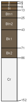
Ustic Natrargids
Well drained
Hydric: No
PAWS: 13 cm
basin floors
Absher
(30%)
Saline Upland Green River and Great Divide Basins (SU)
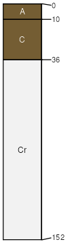
Leptic Torrertic Natrustalfs
Moderately well drained
Hydric: No
PAWS: 15 cm
basin floors
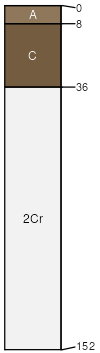
Slick spots
(4%)
Hydric: No
PAWS: NA
Blazon
(4%)
Shallow Clayey High Plains Southeast (SwCy)
Ustic Torriorthents
Well drained
Hydric: No
PAWS: 10 cm
hills
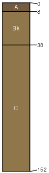
Cragosen
(4%)
Shallow Loamy High Plains Southeast (SwLy)
Ustic Torriorthents
Well drained
Hydric: No
PAWS: 4 cm
hillslopes
Poposhia
(4%)
Loamy (Ly) 10-14 East Precipitation Zone
Ustic Haplocambids
Well drained
Hydric: No
PAWS: 24 cm
fans
hills / Footslope
terraces
fan aprons
Rock outcrop
(4%)
Hydric: No
PAWS: NA
SSA
Scale
Published
Export
wy713
1:24,000
1986
2025-09-04