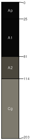
Zell (60%)
Thin Upland
Typic Calciudolls
Well drained
Hydric: No
PAWS: 28 cm |
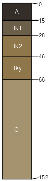
moraines hillslopes / Summit hillslopes / Shoulder hillslopes / Backslope
|
|
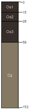
Rothsay (25%)
Loamy
Calcic Hapludolls
Well drained
Hydric: No
PAWS: 32 cm |
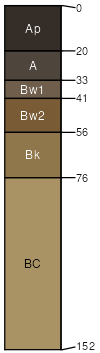
moraines hillslopes / Backslope hillslopes / Shoulder hillslopes / Summit
|
|
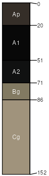
Lakepark (4%)
Hydric: Yes
PAWS: NA |
|
|
Hantho (4%)
Hydric: No
PAWS: NA |
|
|
Quam (3%)
Hydric: Yes
PAWS: NA |
|
|
Areas with more or less slope (2%)
Hydric: No
PAWS: NA |

|
|
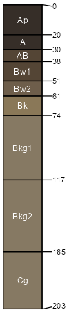
Cathro (2%)
Hydric: Yes
PAWS: NA |
|
|