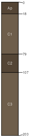
Nodaway-Vesser-Mt. Sterling complex, 0 to 2 percent slopes, occasionally flooded
Nodaway
(40%)
Loamy Floodplain Forest
Mollic Udifluvents
Moderately well drained
Hydric: No
PAWS: 45 cm
flood plains / Toeslope
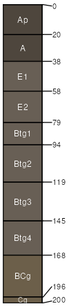
Vesser
(35%)
Wet Floodplain Prairie
Argiaquic Argialbolls
Poorly drained
Hydric: Yes
PAWS: 40 cm
flood plains / Toeslope
Mt. Sterling
(25%)
Wet Floodplain Prairie
Aeric Fluvaquents
Poorly drained
Hydric: Yes
PAWS: 38 cm
flood plains / Toeslope
SSA
Scale
Published
Export
ia177
1:12,000
1994
2025-09-09