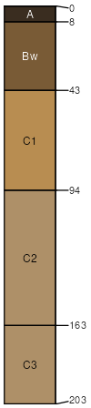
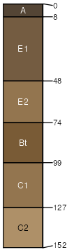
Menahga loamy sand, 1 to 8 percent slopes
Menahga
(85%)
Dry Sandy Upland Coniferous Forest
Typic Udipsamments
Excessively drained
Hydric: No
PAWS: 12 cm
hillslopes / Summit
hillslopes / Shoulder
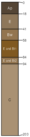
Eagleview
(8%)
Very Dry Sandy Upland Coniferous Forest
Lamellic Udipsamments
Somewhat excessively drained
Hydric: No
PAWS: 12 cm
hillslopes / Summit
hillslopes / Shoulder
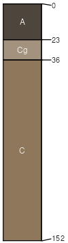
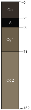
Roscommon
(2%)
Wet Mixed Forest
Mollic Psammaquents
Poorly drained
Hydric: Yes
PAWS: 14 cm
swales
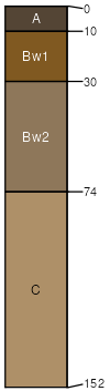
Meehan
(2%)
Moist Sandy Mixed Forest
Aquic Udipsamments
Somewhat poorly drained
Hydric: No
PAWS: 13 cm
swales
Andrusia
(1%)
Very Dry Sandy Upland Coniferous Forest
Arenic Hapludalfs
Well drained
Hydric: No
PAWS: 17 cm
hillslopes / Summit
hillslopes / Shoulder
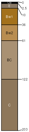
Leafriver
(1%)
Wet Depressional Forest
Histic Humaquepts
Very poorly drained
Hydric: Yes
PAWS: 18 cm
depressions
Wurtsmith
(1%)
Dry Sandy Upland Coniferous Forest
Oxyaquic Udipsamments
Moderately well drained
Hydric: No
PAWS: 14 cm
flats
SSA
Scale
Published
Export
mn021
1:20,000
1993
2025-09-10