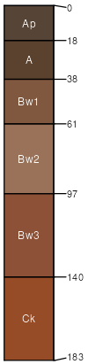
Minco loam, 0 to 1 percent slopes
Minco
(80%)
Loamy Upland
Udic Haplustolls
Well drained
Hydric: No
PAWS: 34 cm
stream terraces
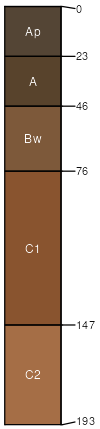
Slaughterville
(5%)
Sandy Loam Upland
Udic Haplustolls
Well drained
Hydric: No
PAWS: 25 cm
dunes
dune fields
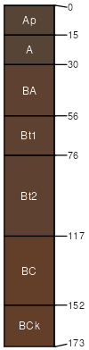
Pond Creek
(5%)
Loamy Upland
Pachic Argiustolls
Well drained
Hydric: No
PAWS: 34 cm
flats
paleoterraces
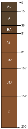
Teller
(5%)
Loamy Upland
Udic Argiustolls
Well drained
Hydric: No
PAWS: 32 cm
paleoterraces
Konawa
(4%)
Deep Sand Savannah
Ultic Haplustalfs
Well drained
Hydric: No
PAWS: 27 cm
paleoterraces
Carwile
(1%)
Depressional Upland
Typic Argiaquolls
Poorly drained
Hydric: Yes
PAWS: 29 cm
depressions
dune fields
SSA
Scale
Published
Export
ok067
1:24,000
1967
2025-08-29