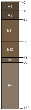
Moskee-Worthenton, moist, association, 0 to 45 percent slopes
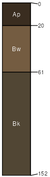
Moskee
(45%)
Sandy (Sy) 15-17 PZ
Aridic Argiustolls
Well drained
Hydric: No
PAWS: 19 cm
hills
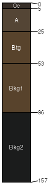
Worthenton
(35%)
Wetland (WL) 10-17 PZ
Typic Argiaquolls
Poorly drained
Hydric: Yes
PAWS: 26 cm
drainageways
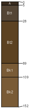
Nuncho variant
(6%)
Clayey (Cy) 15-17 PZ
Hydric: No
PAWS: NA
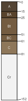
Hargreave
(6%)
Sandy (Sy) 15-19 Northern Plains Precipitation Zone
Hydric: No
PAWS: NA
Coaliams
(6%)
Lowland (LL) 15-17 PZ
Torrifluventic Haplustolls
Hydric: No
PAWS: NA
Worthenton
(2%)
Wetland (WL) 10-17 PZ
Poorly drained
Hydric: Yes
PAWS: NA
drainageways
SSA
Scale
Published
Export
wy633
1:24,000
1987
2025-09-04