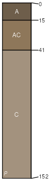
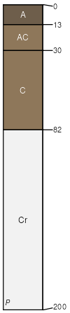
Mitchell (85%)
Thin Upland
Ustic Torriorthents
Well drained
Hydric: No
PAWS: 36 cm |
|
|
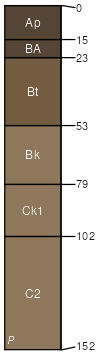
Epping (5%)
Shallow
Ustic Torriorthents
Somewhat excessively drained
Hydric: No
PAWS: 9 cm |
ridges / Summit ridges / Shoulder ridges / Backslope
|
|
Ponderosa (4%)
Sandy 17-20 PZ
Torriorthentic Haplustolls
Well drained
Hydric: No
PAWS: 20 cm |
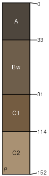
hillslopes / Backslope hillslopes / Footslope
|
|
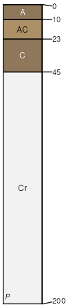
Thirtynine (3%)
Loamy 17-20 PZ
Aridic Argiustolls
Well drained
Hydric: No
PAWS: 36 cm |
hillslopes / Backslope hillslopes / Backslope hillslopes / Footslope
|
|
Keota (3%)
Thin Upland
Ustic Torriorthents
Well drained
Hydric: No
PAWS: 16 cm |
hillslopes / Summit hillslopes / Shoulder hillslopes / Backslope
|
|