Lakoma-Wewela complex, 2 to 6 percent slopes
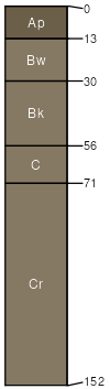
Lakoma
(45%)
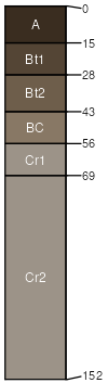
Thin Upland
Typic Ustochrepts
Well drained
Hydric: No
PAWS: 7 cm
plains / Summit
plains / Backslope
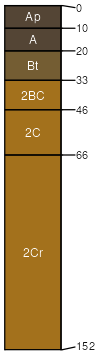
Wewela
(30%)
Sandy 22-25 P.Z.
Typic Argiustolls
Well drained
Hydric: No
PAWS: 13 cm
plains / Footslope
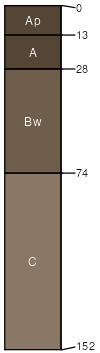
Anselmo
(9%)
Sandy 22-25 P.Z.
Typic Haplustolls
Well drained
Hydric: No
PAWS: 17 cm
plains / Backslope
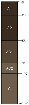
Vetal
(8%)
Sandy 22-25 P.Z.
Pachic Haplustolls
Well drained
Hydric: No
PAWS: 22 cm
swales / Footslope
Holt
(8%)
Sandy 22-25 P.Z.
Typic Argiustolls
Well drained
Hydric: No
PAWS: 10 cm
plains / Shoulder
SSA
Scale
Published
Export
sd053
1:20,000
1982
2025-09-10