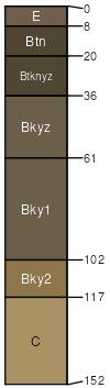
Rhoades (50%)
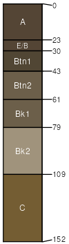
Thin Claypan
Leptic Natriborolls
Well drained
Hydric: No
PAWS: 12 cm |
flats / Summit flats / Footslope drainageways / Footslope drainageways / Toeslope
|
|
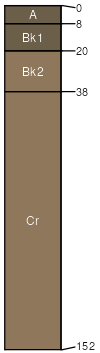
Rock outcrop (35%)
Non-site
Excessively drained
Hydric: No
PAWS: 6 cm |

ridges / Summit ridges / Shoulder hills / Summit hills / Shoulder
|
|
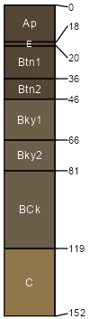
Cabba (3%)
Shallow Loamy
Typic Ustorthents
Well drained
Hydric: No
PAWS: 6 cm |
escarpments / Summit escarpments / Shoulder ridges / Summit ridges / Shoulder
|
|
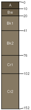
Daglum (3%)
Claypan
Vertic Natriborolls
Well drained
Hydric: No
PAWS: 20 cm |
|
|
Lantry (3%)
Thin Loamy
Typic Ustorthents
Well drained
Hydric: No
PAWS: 13 cm |
hills / Summit hills / Backslope
|
|
Belfield (3%)
Clayey
Glossic Natriborolls
Well drained
Hydric: No
PAWS: 25 cm |
|
|
Slickspots (3%)
Non-site
Well drained
Hydric: No
PAWS: 15 cm |
plains / Summit plains / Backslope plains / Footslope terraces / Summit terraces / Backslope terraces / Footslope
|
|