Boyd-Okaton association, 9 to 25 percent slopes
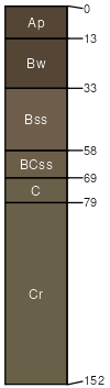
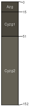
Boyd
(60%)
Clayey
Vertic Haplustolls
Well drained
Hydric: No
PAWS: 7 cm
hills / Backslope
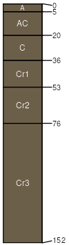
Okaton
(25%)
Shallow Clay
Typic Ustorthents
Well drained
Hydric: No
PAWS: 4 cm
hills / Shoulder
hills / Backslope
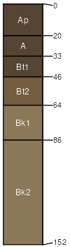
Manter
(7%)
Sandy 22-25 P.Z.
Aridic Argiustolls
Well drained
Hydric: No
PAWS: 19 cm
plains / Summit
plains / Backslope
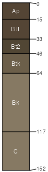
Ree
(7%)
Loamy 18-22 P.Z.
Typic Argiustolls
Well drained
Hydric: No
PAWS: 26 cm
terraces / Backslope
Herdcamp
(1%)
Wet Land
Vertic Endoaquolls
Very poorly drained
Hydric: Yes
PAWS: 22 cm
flood plains / Toeslope
SSA
Scale
Published
Export
sd123
1:20,000
1975
2025-09-10