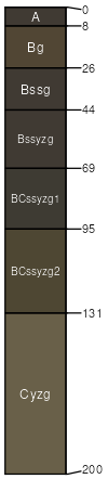
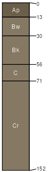
Boyd (85%)
Clayey
Vertic Haplustolls
Well drained
Hydric: No
PAWS: 7 cm |
plains / Summit plains / Backslope
|
|
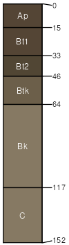
Manter (3%)
Sandy 22-25 P.Z.
Aridic Argiustolls
Well drained
Hydric: No
PAWS: 19 cm |
plains / Summit plains / Backslope
|
|
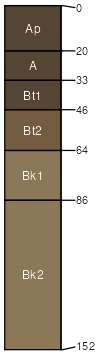
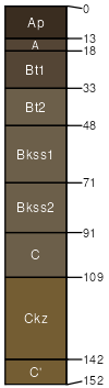
Ree (3%)
Loamy 18-22 P.Z.
Typic Argiustolls
Well drained
Hydric: No
PAWS: 26 cm |
terraces / Summit terraces / Backslope
|
|
Lakoma (3%)
Thin Upland
Typic Ustochrepts
Well drained
Hydric: No
PAWS: 7 cm |
plains / Summit plains / Backslope
|
|
Millboro (3%)
Clayey
Vertic Argiustolls
Well drained
Hydric: No
PAWS: 20 cm |
plains / Summit plains / Backslope
|
|
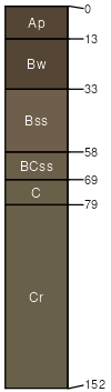
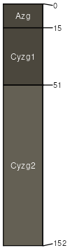
Herdcamp (2%)
Wet Land
Vertic Endoaquolls
Very poorly drained
Hydric: Yes
PAWS: 22 cm |
|
|
|