Ottumwa-Capa complex, 0 to 3 percent slopes
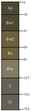
Ottumwa
(55%)
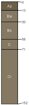
Clayey
Vertic Haplustolls
Well drained
Hydric: No
PAWS: 16 cm
plains / Summit
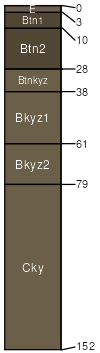
Capa
(35%)
Thin Claypan
Vertic Natrustolls
Moderately well drained
Hydric: No
PAWS: 17 cm
terraces / Toeslope
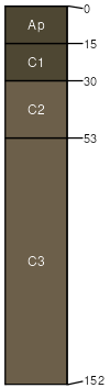
Wendte
(4%)
Clayey Overflow
Vertic Ustifluvents
Moderately well drained
Hydric: No
PAWS: 22 cm
flood plains / Toeslope
Kolls
(3%)
Closed Depression
Typic Epiaquerts
Poorly drained
Hydric: Yes
PAWS: 17 cm
depressions / Toeslope
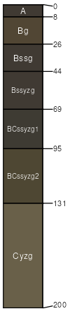
Lakoma
(3%)
Thin Upland
Typic Ustochrepts
Well drained
Hydric: No
PAWS: 7 cm
plains / Summit
plains / Backslope
SSA
Scale
Published
Export
sd055
1:24,000
1992
2025-09-10