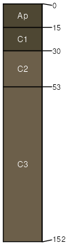
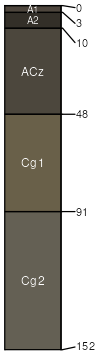
Wendte (65%)
Clayey Overflow
Vertic Ustifluvents
Moderately well drained
Hydric: No
PAWS: 22 cm |
|
|
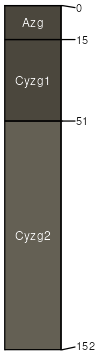
Herdcamp (25%)
Wet Land
Vertic Endoaquolls
Very poorly drained
Hydric: Yes
PAWS: 22 cm |
|
|
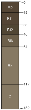
Ree (8%)
Loamy
Typic Argiustolls
Well drained
Hydric: No
PAWS: 26 cm |
|
|
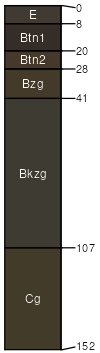
Durrstein (1%)
Saline Lowland
Typic Natraquolls
Poorly drained
Hydric: Yes
PAWS: 18 cm |
|
|
Egas (1%)
Saline Lowland
Typic Haplaquolls
Poorly drained
Hydric: Yes
PAWS: 17 cm |
drainageways / Footslope drainageways / Toeslope
|
|