Badland-Cannonville-Rock outcrop complex, 30 to 50 percent slopes
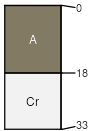
Badland
(45%)
Hydric: No
PAWS: NA
hills / Backslope
breaks
mountain slopes
ridges / Summit
Cannonville
(30%)
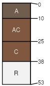
Semidesert Shallow Clay (Mat Saltbush)
Ustic Torriorthents
Well drained
Hydric: No
PAWS: 3 cm
breaks
hills / Backslope
mountain slopes
ridges / Summit
Rock outcrop
(15%)
Hydric: No
PAWS: NA
ledges
cliffs
Cannonville
(5%)
Hydric:
PAWS: NA
Redcreek
(5%)
Hydric:
PAWS: NA
SSA
Scale
Published
Export
ut636
1:24,000
1984
2025-08-27