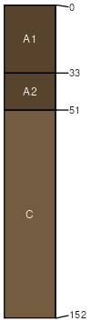
Lihill-Yetull complex, 8 to 35 percent slopes
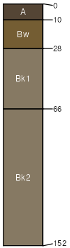
Lihill
(60%)
Sandy-Steep (SyStp) RRU 58A-E 10-14 p.z.
Torriorthentic Haplustolls
Somewhat excessively drained
Hydric: No
PAWS: 13 cm
plains
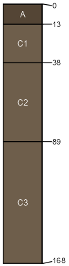
Yetull
(25%)
Gravel (Gr) RRU 58A-E 10-14 p.z.
Aridic Ustipsamments
Somewhat excessively drained
Hydric: No
PAWS: 9 cm
hills / Footslope
hills / Toeslope
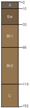
Busby
(5%)
Sandy (Sy) RRU 58A-E 10-14 p.z.
Haplocalcidic Haplustepts
Well drained
Hydric: No
PAWS: 21 cm
plains
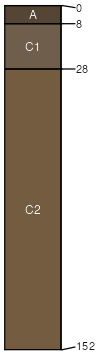
Tinsley
(5%)
Shallow to Gravel (SwGr) RRU 58A-E 10-14 p.z.
Typic Ustorthents
Excessively drained
Hydric: No
PAWS: 4 cm
stream terraces
Yamacall
(5%)
Loamy (Lo) 10-14 P.Z.
Aridic Haplustepts
Well drained
Hydric: No
PAWS: 25 cm
plains
SSA
Scale
Published
Export
mt017
1:24,000
1995
2025-08-27