Hungryhill-Euell-Bullrey complex, 8 to 45 percent slopes, stony
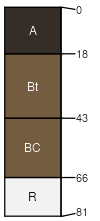
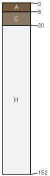
Hungryhill
(40%)
Upland Sagebrush Shrubland Group
Ustic Argicryolls
Well drained
Hydric: No
PAWS: 8 cm
hills / Backslope
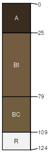
Euell
(25%)
Upland Sagebrush Shrubland Group
Vitrandic Argicryolls
Well drained
Hydric: No
PAWS: 13 cm
hills / Backslope
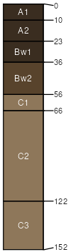
Bullrey
(15%)
Upland Sagebrush Shrubland Group
Pachic Haplocryolls
Well drained
Hydric: No
PAWS: 14 cm
mountains / Backslope
Pappascreek
(10%)
Subirrigated Shrubland Group
Aquic Cumulic Haplocryolls
Somewhat poorly drained
Hydric:
PAWS: 22 cm
drainageways
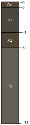
Larkspur
(5%)
Shallow Sagebrush Shrubland Group
Lithic Cryorthents
Well drained
Hydric: No
PAWS: 2 cm
hills / Summit
hills / Shoulder
Rock outcrop
(5%)
Hydric:
PAWS: NA
SSA
Scale
Published
Export
mt670
1:24,000
2007
2025-09-03